| INTRODUCTION
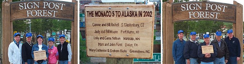
Five couples from different parts of the USA
met in Minnesota on May 30, 2002 to begin the "dream trip of a lifetime".
The couples are the Nelsons from Minnesota, the Moores from Michigan, the
Rishells from Connecticut, the Fursts from Texas, and the Ricks from North
Carolina. What, you may ask, do these couples have in common? They all own
Monaco motorhomes, met years ago at rallys, and have become friends over
the years. Note: You can see our trip planning
documents by clicking
here. |
 |


The Fursts The Moores The Ricks
John and Marti were
born in the East but have become Texans. He was born and educated in
Pennsylvania and spent most of his life as a CPA. Marti hails from Maryland and
was a counselor. Although relative newlyweds (a mere 6 years since they married)
they mutually enjoy his 2 sons and her 3 daughters. Those kids have produced 10
beautiful grandchildren for them to love and visit regularly in their travels.
Life is good, and this trip made it even better. 
Bill and Judy are from Port Huron, Michigan
where they were born and always lived. They met in junior high and dated through
high school and college. After graduating from Michigan State University, Bill
had a career as an independent insurance agent. Judy was a homemaker and part
time elementary teacher after graduating from Albion College. They raised 3
children and now enjoy 5 grandsons. They have had their Monaco motorhome since
1999, and enjoyed this great trip to Alaska.  The Nelsons
Gene and Lolly were born in north
Minnesota, were high school sweethearts and have been together for almost 48
years. They lived in Alaska (while Gene was in service), in Minneapolis, and
presently in Mankato, MN. Gene is an owner/designer and manufacturer of a bin
cleaning equipment business. Lolly is retired from mortgage banking. Their
family consists of son Greg, daughter-in-law Sarah, and 7 year old grandson Noah
(their pride and joy who, fortunately, lives in Mankato, too.) 
Graham and Mary Catherine were both born in
NC. They met in college and have spent all of their married life in Greensboro.
Graham is an electrical engineer with an automation design company. Mary
Catherine is a needlework designer and has an online mail order company. They
have no children but travel with a cat, named Hope, that adopted them 2 years
ago. The Ricks got their motorhome in 1997 and have used it to do needlework
shows for the last four years. They are now semi-retired and, after this trip,
they have been in all 50 states.  The Rishells
Bill and Connie are long-time Connecticut
residents who also have a lot at Outdoor Resorts in Port St Lucie, FL, where
they spend much of their winters. Bill retired five years ago, having been a
geneticist and research director for a major poultry breeding firm. He loves to
trout fish, ties his own flies and anticipated Alaska's offerings in pursuit of
this hobby. Connie is a fun loving person who, with help from Bill, raised two
children. She likes to golf, shop and work with computers. She is the
communicator of the family and keeps everyone informed. The Rishells have five
grandchildren whom they enjoy very much, and who were missed during the Alaska
trip.

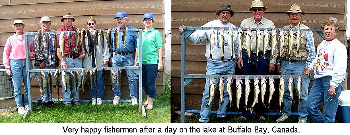
We arrived at Buffalo Bay, a fishing area in Manitoba on
the Canadian border, late in the day on May 31st. Located there is a store in
which to buy fishing licenses and necessities for the fisherman - including
bait, fishing rod paraphernalia, food, and souvenir clothing for those that want
to take home a lasting reminder of their trip to this area.  The lake here is known as the Lake of the Woods.
This very large lake spreads across parts of Minnesota, and the 2 Canadian
provinces of Manitoba and Ontario. Lake of the Woods has the longest shoreline
of any lake in the world, because of its many bays and islands. Commercial
fishing was done here until the early 1990's when it was realized that
over-fishing was taking place and so today the lake is only used for
recreational fishing. The lake is a huge reservoir that is controlled by a big
hydroelectric dam in northern Ontario.
The lake here is known as the Lake of the Woods.
This very large lake spreads across parts of Minnesota, and the 2 Canadian
provinces of Manitoba and Ontario. Lake of the Woods has the longest shoreline
of any lake in the world, because of its many bays and islands. Commercial
fishing was done here until the early 1990's when it was realized that
over-fishing was taking place and so today the lake is only used for
recreational fishing. The lake is a huge reservoir that is controlled by a big
hydroelectric dam in northern Ontario.
Many species of fish are found in
the lake including Sauger, Northern Pike, Sturgeon, small mouth Bass, black
Crappie and Walleye - the fish of choice for most of the people fishing here.
Each kind of fish prefers different areas of the lake based on temperature and
topography. The northern part of the lake, which is located in Ontario, is the
deep area with depths of up to 200 feet. The eastern and southern part is the
rocky, sandy area and the west end is shallow with water depths of 8 to 10 feet.
This is Walleye territory.  At this time of year, most of the fishing boats go out early in the
morning. Our group used three boats. Two went out at 8:00am both mornings and
had caught their quotas by mid afternoon the first day and by lunch the second
day. The third boat, going out at 11am, belonged to Ron, Gene Nelson's brother.
How exciting it was when Noah, the Nelson's 7-year-old grandson, landed his
first and only fish the first day. On day two he made up for it by hauling in
eight!
At this time of year, most of the fishing boats go out early in the
morning. Our group used three boats. Two went out at 8:00am both mornings and
had caught their quotas by mid afternoon the first day and by lunch the second
day. The third boat, going out at 11am, belonged to Ron, Gene Nelson's brother.
How exciting it was when Noah, the Nelson's 7-year-old grandson, landed his
first and only fish the first day. On day two he made up for it by hauling in
eight!
There is a lot to learn about fishing to the casual
observer. Things like how to tell the different kind of fish, what their feeding
habits are, what kind of fishing gear is required to reel them in and what the
fishing rules in an area are. There are many rules in Canada about weight,
length, how many fish and what kinds you can catch. These rules are determined
by the fishing license that you purchase. If you figure the cost of the license,
renting the boat, and buying the bait, on a good day each fish would cost about
$10.00 - and that doesn't count the time it took to catch it. However, watching
them enjoying their hobby, you can see they are having lots of fun just sitting
around waiting on the fish to steal their bait, pass them by or come aboard the
boat. A sign seen in many hospitals states that nurses have "patience".
Certainly, fishermen do to!
Monday, June 3rd, we drove across Manitoba and spent the
night beside a lake at a very nice provincial park in Minnedosa. The next day
was spent driving through the flat farming areas found in Saskatchewan. A
campground at Saskatoon was our overnight host and there, in a nearby field, we
were entertained late that day and first thing the next morning by a red fox and
her 3 energetic pups. We departed Saskatoon, continuing on the Yellowhead Trail
through magnificent farmland on excellent roads on the way to our next stop,
Edmonton, Alberta. Along the way we stopped and visited the very interesting
Ukrainian Cultural Heritage Village.


On June 6th our group visited Alberta's Legislative
Building in the capitol city of Edmonton. The building is an inspiring
architectural structure. Construction took five years and was finished in 1912,
with exterior materials being primarily granite and sandstone brought from
Vancouver and Calgary. The beautiful marble in the interior was imported from
Quebec, Pennsylvania and Italy. A domed central structure, six stories high,
seemed impressive as we looked up from the first floor rotunda. Just inside the
rotunda entrance stands a bronze statue of Princess Louise Caroline Alberta
(daughter of Queen Victoria and wife of the first Lieutenant Governor for which
the providence of Alberta was named) and of Indian Chief Crowfoot (an early
leader who espoused cooperation with the settlers, which led to a peaceful
settlement of Alberta).

The fifth floor offers an amazing acoustical anomaly.
Anyone who stands within a very narrow space (maybe 18" x 30") hears the sounds
of a waterfall. At first it was thought that the roof had a leak. Actually, the
sound of the first floor fountain is somehow projected to this exact spot. This
"waterfall experience" adds to the charm of the building, which, as you might
expect, includes works of art and paintings of leaders throughout the interior.
The exterior grounds are planted with flowers and shrubs, providing an
especially pleasing sight.

That afternoon we viewed an IMAX
movie (large screen where the viewer feels involved in the movement on the
screen) at the Edmonton Space and Science Center, recently renamed Odyssium. The
movie on wolves included beautiful photography of the wilds and provided special
insight as to the place of wolves in the ecosystem. Time was too short to visit
the many exhibits or, for that matter, many other places in the city, however we
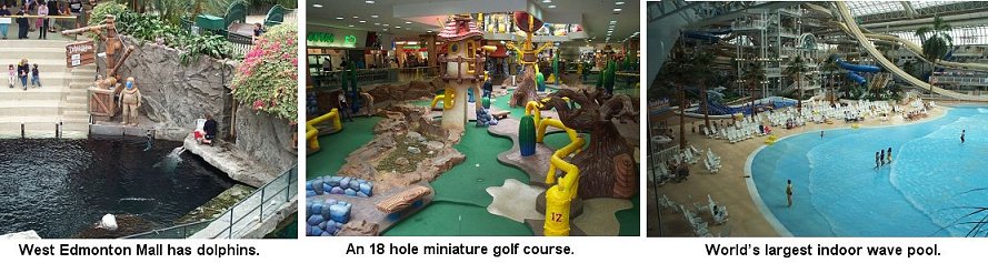
did save time for the West Edmonton Mall, the world's largest mall. There we
found over 800 stores and services, including: an NHL size ice rink, an
amusement park with 29 rides and attractions (one of which is a triple loop
roller coaster), a submarine, over 100 species of marine life including live
dolphins, an 18 hole miniature golf course and a water park that has the world's
largest indoor wave pool. After several hours of "shopping and seeing the
sights" we met for a great meal at a ribs place called Tony Roma's.
We could have spent several more days enjoying the sights and
delights of Edmonton! For all of us there are many reasons to come back.
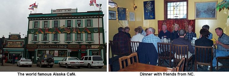
Mid-afternoon on June 7th we arrived at Dawson Creek,
British Columbia. As we headed for our RV park, the Ricks saw motorhomes that
belonged to several of their NC friends in a neighboring campground. Those two
couples joined us that night for dinner at the world famous Alaska Café. This
establishment is a part of the Hotel Alaska which is located about 50' south of
the Mile Zero post in downtown Dawson Creek. Originally known as the Dew Drop
Inn, it was originally constructed as a six room building in 1930. The European
backgrounds of the owners of the café can be seen in the décor, entertainment
and meals. It is mentioned in "Where to eat in Canada", which lists the 500 best
restaurants in the country.

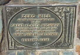
Over the next few days we traveled the Alaska Highway
across British Columbia toward the Yukon. There were 135 bridges constructed on
the Alaska Highway and the Peace Bridge was one of the first goals of engineers
in 1942. Three different trestle bridges were constructed across the Peace
River, only to be washed out by high waters. Today, there is a cantilever and
truss bridge that crosses the Peace River.
On Sunday, we drove down
"Suicide Hill", one of the most treacherous hills on the original highway. It
was noted for it's ominous greeting, "Prepare to meet thy maker." After a short
day of traveling, the group arrived in Fort Nelson right after lunch. We perused
through another museum on the building of the highway and the guys were
particularly interested in the old construction equipment.
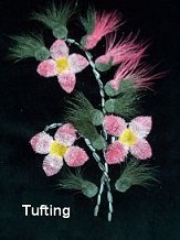
A small arts
and craft store next door revealed pieces of needlework called moose and caribou
tufting and porcupine quill weaving. Moose and caribou tufting is a traditional
form of decorating clothes, belts and bags by the Athapaskan Indians. This very
old needleart had almost been forgotten until recent years. Today it is becoming
more and more popular as it gets better known.
The hair most suitable
for tufting is the 6 to 8 inch winter fur found in the center of the animal's
back. It is hand picked, washed and dyed with natural items such as berries,
moss and bark. Today, commercial dyes such as Rit are used. After dyeing, the
hair is dried and ready for stitching. If a pattern is used, the picture is
drawn onto the velvet or hide with a small stick dipped in flour and water.
About 15 to 20 hairs are held on the pattern, a stitch is made around the hair
and pulled tight and knotted on the back of the material. This makes the hair
stand up in a tuft. The hair is then sculpted with small scissors. Because this
method is used to make a tufting, there are never two exactly alike. Caribou
hair is much softer then Moose hair.


On the way to Whitehorse, we crossed the Continental Divide. This is the area
where the 2 largest drainage systems in North America, the Yukon and McKenzie
Rivers, divide. Water draining to the west of this point flows to the Pacific
Ocean, and water draining to the east goes to the Arctic Ocean. For lunch we
stopped at Mukluk Annie's to partake of our first salmon bake. (A mukluk is a
leather moccasin that comes up high on the leg like a boot). The salad bar and
ribs were excellent, the salmon a little on the dry side. While eating, the
Ricks were surprised by the appearance of Jim and Marlene Phipps, friends from
NC. The Phipps were also headed to Whitehorse and joined us for a few days while
we saw the sights.
Whitehorse got its name from the swift rapids on the
Yukon River that resemble the flowing manes of charging white horses. In 1898,
during the gold rush, stampeders had to bypass these treacherous waters, which
were located just south of the city. The river is much calmer now since the
installation of the hydroelectric dam in 1958. Whitehorse has been the capital
of the Yukon Territories since it was moved from Dawson City in 1953. Over
23,000 people, which is about two thirds of the Yukon population, live here
today. During the construction of the Alaska Highway, Whitehorse was the
headquarters for the western sector. It was one of the two largest construction
camps on the highway.
Since we had toured the Alberta Legislative
building, several of us decided to check out the Yukon Government building. The
present building was completed in 1976 and, though not old and majestic like the
Alberta building, it seemed very functional and had several spectacular pieces
of artwork. Above the foyer was an acrylic resin mural consisting of 24 vivid
panels. This artwork conveyed the historical evolution of the Yukon. The mural,
which is 120' long, is the largest of its kind in the world. The large tapestry
in the legislative assembly chamber, called "Fireweed", is an abstraction of the
Yukon floral emblem. It is made from hand-spun wool that has been dyed to over
100 different shades of color and took one Canadian artist over 1400 hours to
complete. These pieces were nice, but the most impressive art we saw was the
five needlepoint wall hangings located in the Members' Lounge. These panels
depict the role of Northern women in the development of the area, showing the 5
seasons of the North; spring, summer, fall, winter, and "survival", the cold
gray days between winter and spring and between fall and winter. Each hanging
measures 7' X 13' and is worked with heavy tapestry wool on needlepoint canvas
measuring 5 stitches to the inch. Each panel was originally divided into 3
sections so they could be sent to different communities throughout the Yukon to
be stitched. It is estimated that about half of the total population of the
Yukon made at least a few stitches. These needlework pieces were hung for the
official opening of the building in May 1976.


 At the MacBride Museum we saw historical galleries featuring gold rush
exhibits, animals from the area and outdoor displays, which included the cabin
of Sam McGee. McGee was the subject of the Robert Service poem called "The
Cremation of Sam McGee".
At the MacBride Museum we saw historical galleries featuring gold rush
exhibits, animals from the area and outdoor displays, which included the cabin
of Sam McGee. McGee was the subject of the Robert Service poem called "The
Cremation of Sam McGee".  Across from the museum was the North End Gallery. Here we saw works of
art created by Canadians from the "North End" including birchbark baskets.
Birchbark baskets, decorated with porcupine quills, have been made for centuries
by women that live in the Northwest Territories of Canada. After the labor
intensive harvesting of the bark, each basket is meticulously crafted and
requires many hours to fold, shape and stitch together with spruce root and
sinew. The quillwork is the most difficult and time-consuming part of making a
basket. After the quills have been sorted, soaked and dyed, they are softened in
warm water and sewn into unique designs on the basket. A large basket generally
takes about 20 hours to make. Traditionally these lightweight but sturdy baskets
were used for cooking, picking berries, storing items and carrying water. Today
these baskets are valued as art.
Across from the museum was the North End Gallery. Here we saw works of
art created by Canadians from the "North End" including birchbark baskets.
Birchbark baskets, decorated with porcupine quills, have been made for centuries
by women that live in the Northwest Territories of Canada. After the labor
intensive harvesting of the bark, each basket is meticulously crafted and
requires many hours to fold, shape and stitch together with spruce root and
sinew. The quillwork is the most difficult and time-consuming part of making a
basket. After the quills have been sorted, soaked and dyed, they are softened in
warm water and sewn into unique designs on the basket. A large basket generally
takes about 20 hours to make. Traditionally these lightweight but sturdy baskets
were used for cooking, picking berries, storing items and carrying water. Today
these baskets are valued as art. At a trip to "Folknits - North country Knitwear" (www.folknits.yukon.net) we learned about Qiviuq. Muskox have survived in the Canadian arctic for thousands of years. During the winters they are protected from the extreme cold by a long glossy coat of hair that sheds the snow, and a thick undercoat of downy soft hair that insulates the body. This insulation is called "qiviuq" (ki-vee-uk), which means "down" to the Inuit people. As the temperature rises in the spring, the muskox requires less insulation and the qiviuq begins to loosen. It works its way up through the guardhairs and is shed. The qiviuq can then be picked up from the ground or is harvested from animals killed by the Inuvialuit Indians for food. It is then spun into yarn that is knitted into incredibility soft and warm garments. We also noticed a book on knitting with dog hair, with some sample garments nearby.

 On the night of the 13th, many of us visited the Frantic Follies. The
Follies began in 1970 and on opening night the cast outnumbered the audience.
Word spread about their music, magic, comedy, dancing and costumes and today
they boast of a combined audience of over 1 million. The Frantic Follies has the
biggest, most versatile and longest serving cast of any show in the north. The
cast plays over 60 instruments and double as door staff and ushers. All of our
funny bones were tickled during the show, but we all agreed that the skit of
"The Cremation of Sam McGee" was worth the price of the ticket!
On the night of the 13th, many of us visited the Frantic Follies. The
Follies began in 1970 and on opening night the cast outnumbered the audience.
Word spread about their music, magic, comedy, dancing and costumes and today
they boast of a combined audience of over 1 million. The Frantic Follies has the
biggest, most versatile and longest serving cast of any show in the north. The
cast plays over 60 instruments and double as door staff and ushers. All of our
funny bones were tickled during the show, but we all agreed that the skit of
"The Cremation of Sam McGee" was worth the price of the ticket!On the 14th we traveled a few miles out of town and visited with Frank Turner and his dog sled crew. He has 85 adorable "Dukes mixtures" as he calls them. For about an hour we learned about Frank, his dogs and mushing. Mushing is one of the oldest official sports in Canada. Races occur all across Canada; however, the Yukon Quest is the longest race and Frank has participated in all 19 Quests and won in 1995. The Quest runs over 1,000 miles from Whitehorse, Yukon in Canada to Fairbanks, Alaska. They travel 100 to 200 miles between checkpoints with no support enroute. They are totally self-sufficient throughout the race. For example, they cannot replace a dog or sled during the race. Because of this and the extreme northern winters, the Yukon Quest is known as the "toughest race on earth". It was a real treat getting to meet Frank and his friendly canines.

TORTILLA SOUP - Serves 8 to 10.
 Soup may be made 1 day ahead and gently reheated before serving.
3 Tbsp corn oil
4 corn tortillas, coarsely chopped
6 cloves garlic, finely chopped
1 Tbsp chopped fresh epazote (or 1 Tbsp chopped fresh cilantro)
1 cup fresh onion puree
2 cups fresh tomato puree
1 Tbsp cumin powder
2 teasp chili powder
2 bay leaves
4 Tbsp canned tomato puree
2 qts chicken stock
Salt to taste
Cayenne pepper to taste
1 cooked chicken breast, cut into strips
1 avocado, peeled, seeded, and cubed
1 cup shredded cheddar cheese
3 corn tortillas, cut into thin strips and fried crisp
Heat oil in a large saucepan over medium heat.
Sauté tortillas with garlic and epazote over medium heat until tortillas are soft. Add onion and fresh tomato puree and bring to a boil. Add cumin, chili powder, bay leaves, canned tomato puree and chicken stock. Bring to a boil again, then reduce heat to simmer. Add salt and cayenne pepper to taste and cook, stirring frequently, for 30 minutes. Skim fat from surface, if necessary. Strain and pour into warm soup bowls. Garnish each bowl with an equal portion of chicken breast, avocado, shredded cheese, and crisp tortilla strips. Serve immediately.
FRESH GREENS SALAD
3 Romaine Hearts
1 Head Iceburg lettuce
1 can tiny whole red beets, quartered
1 can mandarin oranges
2 med. size tomatoes, sliced
Carrots and onion for color and taste
1/2 16 oz bottle Low calorie Creamy Caesar Dressing

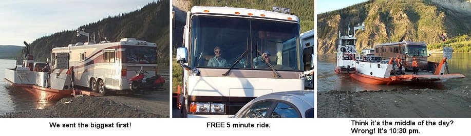
Half way between Dawson City and Whitehorse is Minto, which was once a steamboat landing and trading post. Today it is called an RV Resort and since there is no town here now we found it to be a great place to do some fishing, housekeeping and resting. Traveling in a motorhome requires that we complete some rituals. This is especially true when we move frequently from one campground to another. So far on our trip we seem to have found more than our share of windshield bugs and road dust. This adds to the number of jobs that must (or should) be completed before hitting the highway for our next destination. However, we have found that none of this routine significantly detracts from our adventure. Shown below are some of these rituals.


Our next stop was Dawson City. To get there we took the
road known as the Klondike Loop, a 323 mile stretch of highway which begins
north of Whitehorse, goes through Carmacks and Dawson City, crosses into Alaska
at Boundary, swings by Chicken, and returns to the Alaska Highway south of Tok.
We found the Klondike loop sprinkled with inviting lodges offering
sweets, gifts and unusual ways to entice visitors to stop and check out their
hospitality. One of the most interesting phenomena that we are seeing is trees
that have huge knots on them. Some of the lodges have had these deformed trees
made into the shape of north woods animals. The funniest one we have seen so far
is "Alaska's state bird", better know as the mosquito, seen here with Judy! And
speaking of sweets, during our travels north we have stopped at several places
that sell cinnamon buns, but none have been as large as those we purchased at
the Braeburn Lodge. These tremendous goodies are easily big enough to feed four
people; however, each couple bought one!
We did not stop at Carmacks,
population less than 500. However, it is interesting to know where it got it's
name. George Carmacks established a trading post there in the 1890's. He had
come north hoping to strike it rich but, after many unsuccessful years
prospecting, found himself bankrupt. So in 1896, he moved his family to
Fortymile, were he could cut and sell timber. That summer he continued to
prospect and began to find gold. During the next winter, he extracted more than
a ton of gold from a tiny tributary of the Klondike River that he called Bonanza
Creek. Carmacks' discovery led to one of the greatest human sagas the world has
ever seen - the Klondike gold rush of 1898. Continuing along the loop we came to an overlook of the Five
Finger Rapids. These rapids got their name because of the 5 channels formed by
rock pillars in the river. The rapids were very hazardous and the safest route
for the stern-wheelers was through the east passage. Several of us hiked the
path to get a better look, including the 268 steps that covered the steepest
grades.
Continuing along the loop we came to an overlook of the Five
Finger Rapids. These rapids got their name because of the 5 channels formed by
rock pillars in the river. The rapids were very hazardous and the safest route
for the stern-wheelers was through the east passage. Several of us hiked the
path to get a better look, including the 268 steps that covered the steepest
grades.
When one enters Dawson City, it looks as though the calendar has
been rolled back many years. The streets are still dirt and the buildings look
like the wild, wild west. Here we found a great opportunity to turn back the
pages of time and experience living history. For a short while at the end of the
19th century, Dawson City was a large city boasting a population of over 30,000.
(Today, the population is only a little over 2000.) It became the first capital
of the Yukon and remained so until 1953 when the federal government moved the
capital to Whitehorse. In the early 1960's Dawson City was declared a national
historic site and Parks Canada is currently involved with many of the properties
there, restoring and reconstructing the buildings. 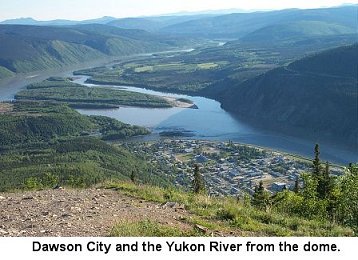 Our first night in Dawson City (the word "night" does not
mean "dark" here) we dined on scrumptious meals at Klondike Kate's and then
drove up to Dome Mountain. On June 21st, if you are on Dome Mountain all night,
you will see the sun barely dip behind the 6000 foot Ogilvie Mountains before it
rises again in a short while. At 9:30 that night, it seemed like the middle of
the afternoon. Very strange, indeed.
Our first night in Dawson City (the word "night" does not
mean "dark" here) we dined on scrumptious meals at Klondike Kate's and then
drove up to Dome Mountain. On June 21st, if you are on Dome Mountain all night,
you will see the sun barely dip behind the 6000 foot Ogilvie Mountains before it
rises again in a short while. At 9:30 that night, it seemed like the middle of
the afternoon. Very strange, indeed.
The morning of the 17th we all took
the 1½ hour guided walking tour which highlighted the history and some of the
notable characters that lived here. After lunch, we learned about the authors
Jack London and Robert Service. Jack London briefly resided in the area and
prospected a claim during the gold rush. It was his stay here that inspired him
to write "The Call of the Wild" and "White Fang". Robert Service, a poet, came
to the area when he was in his early 20's. He answered a San Diego, CA ad run by
a hotel in Dawson City. They needed a person to recite poetry and strum a
guitar. He took a bank job to supplement his income. In 1907, with his bank
Christmas bonus of $100, he published a collection of his own poems. He called
this book "Songs of a Sourdough". By 1966 over 3.5 million copies of this book
had been sold. His two best known poems are "The Shooting of Dan McGrew" and
"The Cremation of Sam McGee".

 Initially, individuals, or small teams, working with
shovels, picks, and the familiar gold pans, dug the gold out of the ground. But
soon thereafter, huge machines were brought in to speed the operation. On the
18th, our group set out to find out more about gold mining in the area. Our
first stop was at Claim 33 on Bonanza Creek where several of us were slightly
successful at panning for gold. We also toured the Gold Dredge #4, which is the
largest wooden hull dredge in North America.
Initially, individuals, or small teams, working with
shovels, picks, and the familiar gold pans, dug the gold out of the ground. But
soon thereafter, huge machines were brought in to speed the operation. On the
18th, our group set out to find out more about gold mining in the area. Our
first stop was at Claim 33 on Bonanza Creek where several of us were slightly
successful at panning for gold. We also toured the Gold Dredge #4, which is the
largest wooden hull dredge in North America. Dredge #4 is 2/3 the size of a football field and 8 stories high. It could dig 48 feet below water level and 17 feet above. A hydro plant located 30 miles away, connected by electric cables laid on top of the ground, provided 920 continuous horsepower. The dredge moved along on a pond of its own making, digging gold bearing gravel from in front, recovering the gold through a revolving screen washing plant, then depositing the gravel out the stacker at the rear. It was a very efficient means of mining for gold.
Only four men were required to operate the enormous dredge - one in front to keep an eye on the digging buckets, one in back to keep check on the stacker, one to continually grease the multitude of huge chains and gears, and the captain to operate a series of levers to control the whole operation. But while only four men worked on the dredge, over a hundred more were required on shore to support it. The land had to be cleared of trees and undergrowth, the earth had to be thawed (no small task in the area of permafrost), and the soil had to be drilled and tested to determine the most promising place to dig.

During our stay in Dawson City, we took in two theatrical productions. The first was at Diamond Tooth Gertie's Casino. There we saw cancan girls and the "star" of the show who did a pretty good rendition of Mae West. After a little unserious gambling, we called it a day. The second show was the "Gaslight Follies" held at the Palace Theatre. This was a lighthearted skit about the early days of Dawson City and the folk that came here during the gold rush.


Today our four coaches (the Fursts were at a family reunion and rejoined us
in Fairbanks) traveled the very scenic "Top of the World" highway. This part of
our trip has been our GRANDEST, but also the most difficult.

 The Canadian stretch of this highway is seal coated and the Alaska
side is gravel. The scenery is positively breathtaking and you truly feel as
though you are on top of the world. However, the highway is closed from
mid-October until April and it is difficult to keep the road in good order.
Repairs are constant while it is open, and there are times when 15mph is
necessary to go over the washboard areas of the road. Other travelers we talked
with said the road was in excellent condition, but that had to be a relative
term - excellent compared to how bad it could be. Fortunately it was dry, but
that caused an incredible amount of dust.
The Canadian stretch of this highway is seal coated and the Alaska
side is gravel. The scenery is positively breathtaking and you truly feel as
though you are on top of the world. However, the highway is closed from
mid-October until April and it is difficult to keep the road in good order.
Repairs are constant while it is open, and there are times when 15mph is
necessary to go over the washboard areas of the road. Other travelers we talked
with said the road was in excellent condition, but that had to be a relative
term - excellent compared to how bad it could be. Fortunately it was dry, but
that caused an incredible amount of dust. A little town called Boundary is at the Canadian/Alaskan border, at an elevation of 4,127 feet. As we crossed the border, we were asked what citizenship we held, what our purpose in coming to Alaska was, and if we had pets; then told to have a nice vacation and off we went.
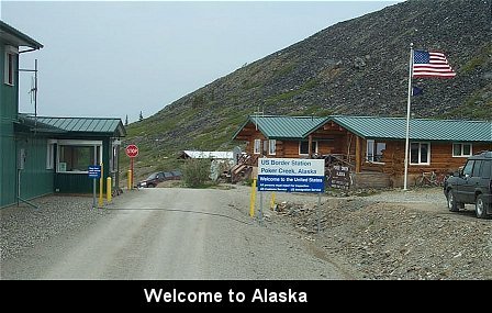
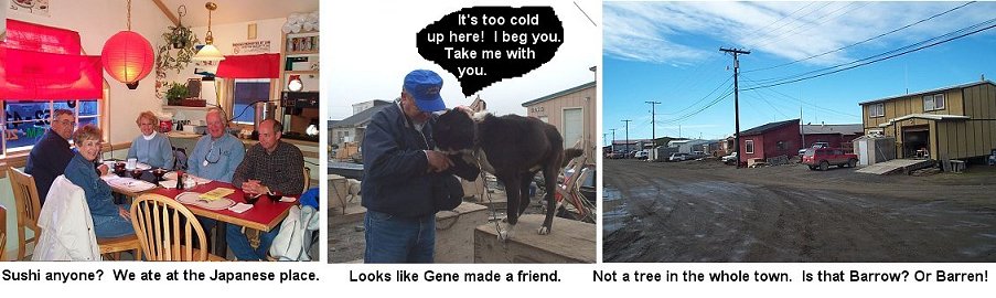
Our first stop inside Alaska was at "beautiful downtown Chicken". "Why Chicken?" you may ask. Well, because the original settlers couldn't spell Ptarmigan, which is what they wanted to call the town. You see, this bird was plentiful and it made many a meal for the miners. Chicken's winter population is about 15, which soars to around 40 during the summer. Folks are here to mine gold. The town is closed during the winter since the road is closed. The temperatures may dip to -80 and soar to 45 degrees. There are NO telephones and NO flush toilets. Mail arrives by plane on Tuesdays and Fridays, if the weather is good. There are many 4-legged animals in the area, occasionally bears walk through town. The closest town is 78 miles away. Don't you wish you were living in Chicken?

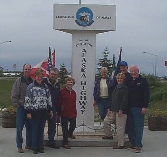 The next day we traveled approximately 100 miles north to
Delta Junction. This was a beautiful ride with snow-capped mountains paralleling
our route as we drove northbound. An overnight rain in Tok was likely snow in
the higher elevations because the peaks were covered in fresh snow. It was a
gorgeous sight on a clear morning with the sun hitting the mountaintops. The
actual end of the Alaska Highway is in Delta Junction, not Fairbanks as has been
reported on occasion. In the early 1980's the Alaska Department of
Transportation made some highway sign changes that caused a lot of confusion for
travelers. This misunderstanding was easily remedied with a trip to the Visitors
Center in Delta Junction where one can see the monument for the official end of
the highway.
The next day we traveled approximately 100 miles north to
Delta Junction. This was a beautiful ride with snow-capped mountains paralleling
our route as we drove northbound. An overnight rain in Tok was likely snow in
the higher elevations because the peaks were covered in fresh snow. It was a
gorgeous sight on a clear morning with the sun hitting the mountaintops. The
actual end of the Alaska Highway is in Delta Junction, not Fairbanks as has been
reported on occasion. In the early 1980's the Alaska Department of
Transportation made some highway sign changes that caused a lot of confusion for
travelers. This misunderstanding was easily remedied with a trip to the Visitors
Center in Delta Junction where one can see the monument for the official end of
the highway. As we neared Delta Junction, we stopped at the Delta Meat and Sausage Company. They make homemade smoked and fresh sausages. After sampling their products, most of us purchased several items including caribou and elk sausages.
 On arrival in Delta Junction, we headed for Rika's Roadhouse, located
on the banks of the Tanana River. The Roadhouse is a large building, constructed
of logs in the early 1900's. It gave travelers a place to stay on their way from
Valdez to Fairbanks. John Haidukovich originally owned the homestead. He would
leave it in the care of Rika Wallen while he was trading in the winter and
guiding in the summer. After 5 years of hard work with no pay, she asked for and
received the homestead in place of back wages.
On arrival in Delta Junction, we headed for Rika's Roadhouse, located
on the banks of the Tanana River. The Roadhouse is a large building, constructed
of logs in the early 1900's. It gave travelers a place to stay on their way from
Valdez to Fairbanks. John Haidukovich originally owned the homestead. He would
leave it in the care of Rika Wallen while he was trading in the winter and
guiding in the summer. After 5 years of hard work with no pay, she asked for and
received the homestead in place of back wages. We toured some of the historic buildings of this 10-acre park and visited the gift shop. Inside, Connie Rishell introduced herself to Vicki Greenleaf, wife of Connie's second cousin Ron. In 1982, Ron and his brother Richard Greenleaf, with their wives and one child each, moved from New England to Alaska, where they have lived for 20 years. Both families are active in a non-denominational Christian group that runs and manages the Roadhouse and buildings via a lease with the state of Alaska. Vicki accompanied us to the restaurant for lunch and then very graciously gave our group a guided tour, encouraging us to try on some of the beautiful items in the gift shop.

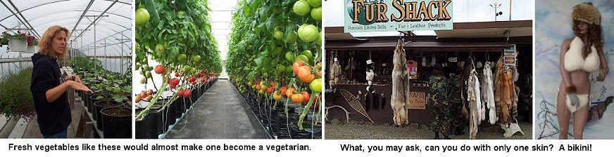
Several of us also checked out the Fur Shack, the Delta Junction furrier that makes coyote headbands and earmuffs. This mom and pop company operates at a roadside stand near the Alaska Pipeline. This is our first viewing of the trans-Alaska pipeline and here it crosses the Tanana River.

 |
"North Pole, Alaska" - That has a Christmassy ring, don't you think? Bon
Davis homesteaded this area in 1944. A development company bought the property
and named it North Pole, hoping to attract a toy manufacturer who could
advertise products as being made at the North Pole. The toy maker concept fell
through so the town incorporated in 1953 and adopted the theme: "Where the
spirit of Christmas lives year round." You know you have arrived at the North
Pole when you see the world's tallest Santa, which stands over 40 feet
high.

One couple in our group, the Nelsons, lived in Fairbanks from 1959 to 1961. They traveled the Alaskan Highway a total of four times when it was all dirt (approximately 1500 miles each way). Now it is a composite of gravel and sand covered with oil. This seems to handle the weather conditions better and is easy to repair. Many of the curves and dangerous areas have been changed, which has shortened the highway by approximately 20 miles. First published in 1949, the "Milepost" gave mile-by-mile information on all major highways and roads in Alaska and northwestern Canada. Early travelers relied heavily on it for gas, food, repairs and lodging information. Today the "Milepost" is directed more toward tourists and is therefore full of advertising. After 43 years, the Nelsons are seeing many changes.

Fairbanks functions as a hub for the interior of Alaska, via river, road and rail and is the second largest city in Alaska. It held a key role during the construction of the trans-Alaska pipeline in the 70's. Extractive industries such as oil and mining continue to play a major role in the economy. Government employment, approximately 50%, is a big boost to the economy along with the University of Alaska and retail businesses. Ladd Field, now known as Fort Wainwright, was the first Army airfield in Alaska and is the city's largest employer.
 Temperatures in Fairbanks can dip to 60 below in winter and rise to 90
above in the summer. You haven't lived until you've driven on tires that have
frozen flat on the bottom - thump! thump! After months of only a few hours of
daylight, returning sunlight in late winter is a welcomed sight. On June 21st
Fairbanks has 21 hrs and 59 minutes of sun. There never seems to be a "time" to
go to bed.
Temperatures in Fairbanks can dip to 60 below in winter and rise to 90
above in the summer. You haven't lived until you've driven on tires that have
frozen flat on the bottom - thump! thump! After months of only a few hours of
daylight, returning sunlight in late winter is a welcomed sight. On June 21st
Fairbanks has 21 hrs and 59 minutes of sun. There never seems to be a "time" to
go to bed. Fortunately we were in Fairbanks on Saturday, which gave us the opportunity to explore the Tanana Valley Farmers Market. This market began in the mid 70's with the purpose of showcasing a wide variety of "Alaska Grown" produce and "Made in Alaska" arts and handicrafts. It is the oldest established farmers market in Alaska, and the only one located in its own permanent building. We had great fun there, buying more fresh produce from our Delta Junction hydroponics gardener, wild berry jams and jellies, baked goods, reindeer sausage, pottery and a handmade fleece coverlet.
From there we went to the Great Alaskan Bowl Company (see their website at http://www.woodbowl.com). This company can take a single split log and cut up to 8 solid one-piece birch bowls. The bowls are made from freshly cut trees with a 13" or greater diameter. The logs are cut in lengths and then split for turning. The wet bowls are then stacked in a kiln, which monitors the heat and moisture. This is the most critical step in the bowl making process because if it is done incorrectly the results are many cracked bowls. The bowls are removed from the kiln when the moisture content reaches 6-10%. They are then sanded, branded, inspected and lastly dipped in block oil. Each bowl actually goes through 22 individual steps before they are ready to be sold. The bowls can be used for hot or cold foods. Clean up is easy. Simply hand wash in warm, soapy water. Towel dry and oil occasionally. We were impressed and most of us purchased bowls.


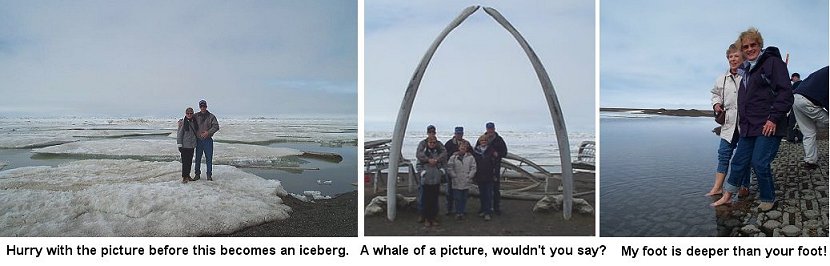
On Sunday, June 24th, three couples climbed aboard an Alaska Airlines plane and ventured to Barrow at the "Top of the World" - which we all decided was more like the END OF THE WORLD. Barrow is 330 miles above the Arctic Circle and is the northernmost settlement on the North American Continent. Even though Barrow is only accessible by air or barge it still boasts a population of 4,500 people, most of which are the Inupiaq people.
Barrow has an airport, city hall, police department, hospital, elementary, middle and high schools, a two-year college, hotel and inns, a few restaurants, and a recreation and senior center. Modern facilities include water, sewer, cable TV and advanced communications, made possible by satellite dishes aimed almost parallel to the ground because of being so far north. Weather in Barrow can change by the hour. Summer temperatures vary, but average around 40 degrees. There are NO trees in the Arctic, the waters are icy and the land is mushy tundra.
In Barrow, we found that native culture is still the center of their life. Festivals are held throughout the year celebrating these traditions of the native people. One celebration is held in honor of a successful whaling season and another celebrates the return of the sun after 65 winter days when the sun never shines.

Other things we did in Fairbanks included visiting the El Dorado Gold Mine and playing a round of golf under the midnight sun at the North Star Golf Club which is America's northernmost golf course. And, of course, we dined at many of the local hot spots, including the Pumphouse and Pikes Landing. The Nelsons, remembering what it was like 40 years ago, found an entirely different city unfold before their eyes. Very few familiar sites remained downtown, mainly due to a flood of the Chena River in l967. The last night in Fairbanks, they had the pleasure of dining with the widow of Lolly's boss from those days and were given a narrated tour of the old and new.

It was exciting to arrive in Denali National Park and
Preserve. Snow capped peaks, vast wilderness and spectacular wildlife define its
magnificence. The park is larger than Massachusetts and has North America's
highest peak, Mt. McKinley (Denali), which is 20,320 feet high. This mountain's
vertical relief of about 18,000 feet is greater than that of Mount Everest.
Permanent snowfields cover more than 75% of the mountain and contribute to the
many glaciers that surround its base. The mountain consists of granite and
slate, which is covered by ice that is hundreds of feet thick in some
places.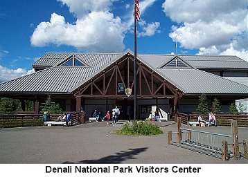 Denali, meaning "The High One", is the name Athabasean native people
gave the massive mountain. In 1896 a prospector named William Dickey named the
mountain for presidential nominee William McKinley of Ohio, although McKinley
had no connection with Alaska. Protests arose quickly, but it was not until 1980
that the name was changed back to Denali. Through the years the park's boundary
has been enlarged from 2 million to 6 million acres.
Denali, meaning "The High One", is the name Athabasean native people
gave the massive mountain. In 1896 a prospector named William Dickey named the
mountain for presidential nominee William McKinley of Ohio, although McKinley
had no connection with Alaska. Protests arose quickly, but it was not until 1980
that the name was changed back to Denali. Through the years the park's boundary
has been enlarged from 2 million to 6 million acres.
The park is managed
as three distinct units: Denali Wilderness maintains the undeveloped wilderness
character of the park; Denali National Park allows customary and traditional
subsistence uses by local rural residents; and Denali National Preserve controls
sport hunting, trapping and fishing.
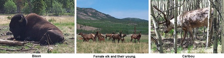
Denali is one of the world's last
great frontiers for wilderness adventure. It remains largely wild and unspoiled.
This expansive wilderness landscape is habitat for caribou, moose, red fox,
wolf, lynx, black bear, Dall sheep and grizzly bears. A diversity of wildlife
includes 161 species of birds, 37 species of mammals and 450 species of plants.
The timberline in the park is at 2,700 feet. Below the timberline are vast areas
of taiga and sub-artic tundra. "Taiga" is a Russian word that means northern
evergreen forest. In Denali, taiga consists primarily of white and black spruce.
"Tundra" is shrubs and small plants. There are two types of tundra, moist and
dry. Although small in statue, plants of the dry tundra are important because
their nutrients provide food for many species of park wildlife, both large and
small. Deep beds of intermittent permafrost underlie portions of the park and
preserve. Permafrost is formed when the soil temperature is about 27 degrees and
ice slowly forms in the poorly drained soils.


We left Denali National Park feeling completely overwhelmed by the grandeur
of Mt. McKinley, the Alaskan Mountains, the parkland, and the wild animals. Our
group decided to pause at the tiny village of Talkeetna on our way to Anchorage.
A wayside stop just before the village offered another splendid view of Mt.
McKinley and the Alaskan Mountain range.

 After an enjoyable few hours, we headed on to Anchorage, which sits at
the base of the Chugach Mountains along the coast of Cook Inlet in South-central
Alaska. Anchorage, Alaska's largest city is about the size of New Jersey and has
nearly 261,000 people - 42 % of the state's population. Protected by the
mountains and warmed by Japanese currents of the Pacific Ocean, Anchorage enjoys
a temperate, maritime climate with summer highs close to 80 degrees and winter
snows, which often cause the temperature to dip into the twenties. Low humidity
also contributes to this more comfortable climate.
After an enjoyable few hours, we headed on to Anchorage, which sits at
the base of the Chugach Mountains along the coast of Cook Inlet in South-central
Alaska. Anchorage, Alaska's largest city is about the size of New Jersey and has
nearly 261,000 people - 42 % of the state's population. Protected by the
mountains and warmed by Japanese currents of the Pacific Ocean, Anchorage enjoys
a temperate, maritime climate with summer highs close to 80 degrees and winter
snows, which often cause the temperature to dip into the twenties. Low humidity
also contributes to this more comfortable climate. On arriving in town, we were greeted by Marti's sister. Joanne and her husband, Tom, moved to Alaska in 1967. He is a pilot and she works for the post office. Thanks to Joanne, the ladies had beauty salon appointments at the largest mall in town. After getting beautified, they all met at the food court for lunch and then took advantage of being at the mall. What a rejuvenating and fun way to start off our time in Anchorage.
On the second day in town, many of us chose to take a narrated trolley tour of the downtown area. We started the tour by going to Lake Hood Air Harbor. This is the largest and busiest floatplane base in the world and is a popular starting point for flightseeing and fly-in fishing trips. Our next stop was Earthquake Park, which is an area destroyed and later dedicated as a park to commemorate the Good Friday Earthquake of March 27, 1964. The highlight of the tour was the visit to the 4th Avenue Theatre. This building is a historic landmark, which was built in 1947. This grand building was the first million-dollar building built in Alaska and was one of the few to survive the 1964 earthquake. There we saw floor to ceiling brass and copper murals depicting life in Alaska during the 1940's. After the tour we had a delicious halibut buffet and a very entertaining show at this theatre. The best part of the show was when the fiancée of one of the young ladies in the show appeared unannounced and proposed to her, right there in front of everyone. Wow! What a surprise. Of coarse it was not until the end that we knew for sure that it wasn't just another part of the show. It certainly brought happy tears to more than one pair of eyes.

The other part of the Experience Center was the Alaska Earthquake exhibit. We learned that on Good Friday, March 27, 1964 an earthquake lasting 5-1/2 minutes rocked Anchorage. This quake that measured 9.2 on the Richter scale was the strongest ever-recorded in North America. Areas in Anchorage dropped up to 100 feet and nine people lost their lives. Tidal waves ripped through the coastal cities wiping out entire towns and adding 154 more fatalities. At the "Experience Center" we relived this history through a movie presentation that had the added feature of shaking and rumbling our seats for an authentic effect. We were glad we were not in Alaska during the earthquake and were amazed that there were not many more people killed.
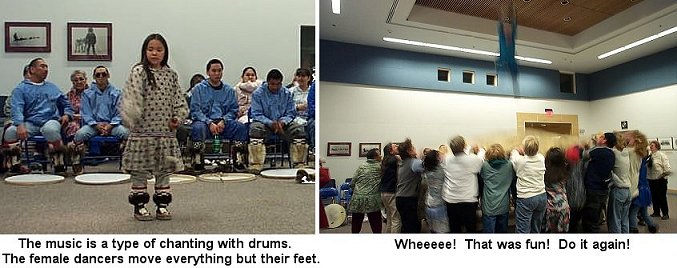
 On another day several from our group toured the Alaska Native
Heritage Center. They learned a great deal about Alaska's eleven indigenous
cultures through exhibits, displays, dance, storytelling, and recreated village
sites.
On another day several from our group toured the Alaska Native
Heritage Center. They learned a great deal about Alaska's eleven indigenous
cultures through exhibits, displays, dance, storytelling, and recreated village
sites.One night we dined at the Sourdough Mining Co. and our lighter side was explored through attendance at the Dusty Sourdough show. Dusty told jokes, sang and played his guitar. At the end of the show Graham won a very small (one square foot) gold mining claim in Talkeetna, AK. After the show we moseyed over to Wild Berry Products. This was one of the many shops available that feature native and other Alaskan made products.
During the summer, Anchorage is noted for the profusion of flowers and hanging baskets that decorate homes and businesses. Parks, street medians and lampposts are vibrant with the colors of millions of flowers. An estimated 100,000 hanging baskets are seen everywhere. It is obvious that residents love their flowers and are proud of their city.


We departed Anchorage on July 3 bound for Homer, on the
southwest side of the Kenai Peninsula. Our route paralleled the Turnagain Arm, a
long narrow bay off Cook Inlet. There is a tragic history associated with this
bay. It is normal to have tide swings in this region in excess of 25 ft, with
extremes at low tide exposing long, wide mudflats. These mudflats are composed
of glacial mud and silt, which acts like quicksand to the unsuspecting hiker who
happens to venture out on them during low tide. Many people have been trapped in
this mud and, with the changing tides, have drowned before they could be freed.
Signs warn of this danger all along the banks of this bay. The drive on the Sterling Highway from Kenai to Cooper
Landing was absolutely breathtaking. Going through the lush green Chugach
Mountains and tall spruce trees that lined the sides of the road was like
driving through a tunnel. The Kenai Princess Lodge RV Park, where we stayed, was
a small park surrounded by the mountains. It was a beautiful setting.
After leaving Seward, we decided to make 2 brief stops, one at Whittier and
the other at Alyeska. Whittier, named after the poet John Greenleaf Whittier, is
nestled at the base of mountains. The US Army created it during World War II as
a "secret port" that would be used to deliver petroleum to bases farther north.
In 1943, a 2.5-mile railroad tunnel was constructed. This allowed Whittier to
become the primary port for troops and cargo to get into Alaska. The Army left
Whittier in the 1960's, and in 1969 it was incorporated. In 1973, the city
purchased the town site from the federal government. Today it is a small
community of only 290 residents.
We left Hyder the morning of the 29th, thinking that our
return to Canada would be a piece of cake. After all we had crossed the borders
many times, with no problems, and there's really no place a motorhome can go in
Hyder except back into Canada. Boy were we surprised when the Fursts were
detained and asked to leave their coach while it was thoroughly searched. Of
course, no contraband was found, and this was the only unpleasant reminder on
our whole trip of how our lives have been changed since the terrorist attack.
Leaving the Yellowhead Trans-Canada Highway and traveling
south on the Icefields Parkway, from Jasper to Banff, was a highlight on our
journey. Because the route follows the Continental Divide, it passes through
high altitude terrain and a chain of huge glacial ice fields that are never out
of sight on a clear day. The highest point is Bow Pass, and it's elevation is
6,875 feet. Bow Pass is a watershed divide. On one side the Bow River flows
toward Calgary, and on the other side the Saskatchewan River flows to Edmonton.
Along the way we were excited to see a beautiful elk (one with a tremendous
rack, a few feet from the road), mountain goats, a large black bear swimming
across a river, and deer.
The next several days the Moores and Ricks traveled across
the southern part of Canada, skirting around the top of Lake Superior. They
entered back into the United States at Sault Ste. Marie, MI and decided to spend
a day on Mackinac Island. On Sunday morning the Moores headed for home, Port Huron,
MI. The Ricks still had several more days to travel before reaching home in NC,
so we decided to see some more of Michigan while in the area. We began in
Mackinaw City, where we watched a 30-minute film on the construction of the
Mackinac Bridge.

Homer has
a population of 4000 and sits on Kachemak Bay. Kachemak is a native word meaning
"fog on the bluffs". The town sits in a postcard type setting. Most of the
residences are perched on the bluff and hillside, and the business district sits
closer to and along the water. Homer is unique in that a long narrow spit
(peninsula) extends four miles out into Kachemak Bay. Along the eastern side of
this spit is a huge marina, which houses the fishing fleet and other pleasure
boats. Several bald eagles flew close by as we drove out onto the spit that
first evening. Homer is the Halibut capital of Alaska; in 2001, 12 million
pounds were shipped to consumers worldwide.

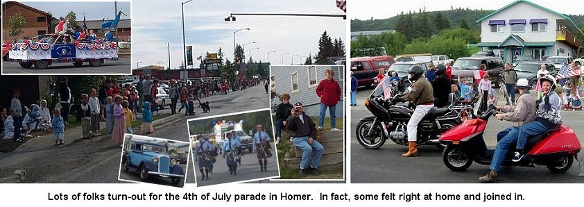
A FOURTH TO REMEMBER!
The fourth of July was a fun day for us. The
owners of our campground hosted a noon picnic, supplying halibut, hot
dogs, and desert and everyone brought a potluck dish. A raffle was held
following ice cream & cake and six of us were lucky winners. Later in
the afternoon, several of us witnessed the Homer Independence Day Parade.
To our surprise, the motorcycle brigade included the Ricks.

 Friday morning saw most of us out on the town visiting the local shops
before our noon departure via charter boat, called the Stormbird, for Gull
Island and Halibut Cove. The sights and sounds of Gull Island were interesting,
but the smell was not. This island is a rocky outcropping, consisting of two
acres, but it is estimated that approximately 16,000 birds use it regularly as
their nesting site. The island is home to 9 species of birds but many others are
found here during migration. It seemed as if the entire island was alive. We
were fortunate to see a pair of tufted puffins, which is a somewhat rare
sighting.
Friday morning saw most of us out on the town visiting the local shops
before our noon departure via charter boat, called the Stormbird, for Gull
Island and Halibut Cove. The sights and sounds of Gull Island were interesting,
but the smell was not. This island is a rocky outcropping, consisting of two
acres, but it is estimated that approximately 16,000 birds use it regularly as
their nesting site. The island is home to 9 species of birds but many others are
found here during migration. It seemed as if the entire island was alive. We
were fortunate to see a pair of tufted puffins, which is a somewhat rare
sighting.
We continued on to Halibut Cove, a charming village on
Ismailof Island, which was home to a herring fishery a century ago. Today a few
dozen residents, largely fishermen and artists, inhabit this village.
We
visited several artists' galleries, including Diana Tillion's workshop. Diana is
known for her sepia colored paintings, done with octopus ink. Sepia color is
multiple shades of brown. The word "sepia" is Latin for cephalopod, and an
octopus is a cephalopod. Octopi use their ink as a defense mechanism, injecting
it in the water to confuse their prey. Diana harvests the octopi, withdraws the
ink with a syringe and then returns them to the water where they reproduce their
ink supply. She is pretty sure that she has gotten ink from the same octopus on
several occasions. The ink is very dense and only a very small amount is needed
to produce a painting. The ink is indelible and transparent, so water is added
and the paintings are done by using the lightest shades and working to the
darkest ones. Most of the paintings she had on display were of landscapes and
birds in the area. Strolling the12 blocks of boardwalk, we checked out the other
galleries and enjoyed a beautiful day of scenery before boarding our boat for
the return to Homer.


For dinner, the night of the 5th, Bill Moore (alias Billy Boots Moore
Fun) was our chef and prepared great hamburgers on the grill. The ladies
chipped in with other goodies. We all agreed that, up to this point, this
was one of our best meals; and it was fun to eat it outdoors in such a
beautiful setting.
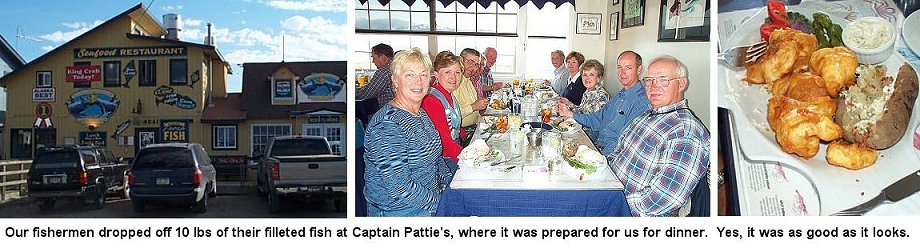
THANK GOODNESS FOR GOOD FISHERMEN!
Saturday was a fishing day for
four of the men while the women explored the shops. Gene, John and Bill
Moore boarded a halibut charter for a day of halibut and salmon fishing.
Bill Rishell visited the Anchor River, with fly rod in hand, in search of
Dolly Varden, a sea run trout similar to the brook trout. Each of them was
successful in different ways. The charter fishermen caught their limit of
halibut plus one small salmon, all of which were processed and shared.
Approximately 10 pounds of halibut and the salmon were then taken to a
local restaurant where the chef prepared it to our order for dinner that
evening. Our trout fisherman caught nothing, but did manage to hook 2 king
salmon, fighting each for most of an hour before they broke the 9 lb test
fly leader. Both fish were estimated to be about 3 1/2 feet long and weigh
thirty pounds or more. Bill said it was an incredible experience and that
he "got most of what each fish had to offer." 
YUM YUM GOOD!
We departed Homer on Sunday for the sixty mile
trip north to Kenai, taking with us fond memories of our stay in Homer. As
we were preparing to depart, a moose cow with calf crossed the road not
far from our campground. This was a fitting climax to our visit to this
lovely area.
On our way to Kenai we stopped at the General Store in
Ninilchik to browse for souvenirs, but the memorable note about this stop
was the huge size of the one dip ice cream serving that several of us
enjoyed. 
We arrived in Kenai and checked into
our park overlooking the mouth of the Kenai River where it flows into Cook
Inlet. The sockeye salmon were jumping and several fishermen had taken positions
along the river to cast for them. That evening we saw several fish that had been
caught and were told that the second run of sockeyes was just beginning. Bill
Rishell tried his luck the next day with no success.


HELPING FRIENDS
Another notable occurrence that developed this
weekend was that the Ricks' fuel tank began to leak diesel fuel. All the
guys pitched in to help Graham empty the tank and remove it from his
coach. The next day it was taken to a welding shop and repaired. After he
reinstalled it in the coach and fuel was added, the engine started
immediately. An amazing feat and we were ready to depart Kenai for our
next adventure.
Cooper Landing is not your average town. It is a roadside community that
stretches for about six miles along the Sterling Highway. Cooper Landing was
named after Joseph Cooper, a miner who discovered gold in 1884. A school and
post office opened in the 1920's and roads were built in the late 40's and early
50's to Kenai and Anchorage. Today the population of Cooper Landing is around
369 and swells to twice that size in the summer to support the tourism industry.
Although our stay here was only one day, we still found time to get in a
few activities including eating and shopping at Gwin's Lodge and store. This
lodge is one of Alaska's oldest, traditionally built, log roadhouses. The Gwin's
completed the lodge in 1952, after cutting, hauling and hand peeling the logs in
true pioneer fashion. In 2000, "USA Today" selected Gwin's as a Top 50
"America's Best Plates" restaurant.
Cooper Landing is sandwiched between
two of Alaska's most popular rivers, the Russian and the Kenai. The best way to
see these two large rivers is to take a raft trip. This is also a nice way to
learn a little history and see some wildlife.

Every time
we leave an area we think it has to be the best we'll see. However, once again
we were proven wrong as we journeyed to Seward. Located between Resurrection Bay
and the Kenai Mountains, Seward is 127 miles from Anchorage. This stretch of
highway, called the Seward Highway, is considered one of the most scenic in the
U.S. The population of Seward within the city limits is about 2500, plus another
400-plus prisoners at the state's only maximum security prison, located across
the bay. Adding the residents in the vicinity around Seward, there are about
5000 people in the area.
The city was named for William H. Seward,
Abraham Lincoln's Secretary of State. He was responsible for buying Alaska from
Russia in 1867 for $7.2 million. At that time (before the later Gold Rush and
discovery of oil) the purchase was considered so stupid it was called "Seward's
Folly". Seward is among Alaska's oldest and most picturesque communities. It is
known as the "Gateway" to the Kenai Fjords National Park, a very spectacular
national park. Seward was established in 1903 by railroad surveyors as an ocean
terminal and supply center. The railway connecting Fairbanks, in the interior,
with Seward was completed in 1923. Today Resurrection Bay is a year-around
ice-free harbor and Seward is an important cargo and fishing port.
On
Good Friday, in 1964, an earthquake changed Seward's destiny forever. Damage
from the earthquake was immense but was just the beginning of Seward's troubles.
Oil storage tanks along Resurrection Bay exploded and caught on fire. Afraid,
people headed out of town, but the bridge had sunk five feet and there was no
way out. Large portions of the waterfront, 50 to 400 feet wide, simply fell into
the water. Gigantic waves caused mass destruction. Then came the tsunamis (tidal
waves). The first wave, as wide as the bay and 30 feet high, rolled in about 30
minutes after the quake began. They continued until the following morning. It is
amazing that only thirteen people in Seward were killed. All of Seward's
waterfront industry was totally destroyed. This completely changed Seward's
landscape and economy. To us, it looks as though nothing ever happened; but for
many of them the scars will remain forever.
Steward has its lighter
side. Every Fourth of July the town swells to 25,000 to watch more than 800
runners scramble up and slide down the steep, eroded trail of Mount Marathon.
The world famous races take runners 1.5 miles up from sea level to an altitude
of 3,000 feet and back down. Current record is 43 minutes 23 seconds for men and
50 minutes 30 seconds for women.


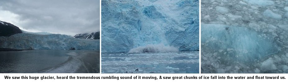
 No one knows for sure how deep the ice is there. An
estimated 150 to 200 inches of precipitation fall on the icefield annually. As
layers of snow and ice build up, light fluffy crystals and frozen water are
compressed into dense ice. Firnification, which is this process of compacting
snow and ice into glaciers, depends upon the balance between accumulation of
snow and glacial melting. Wherever precipitation exceeds the melting, layers of
"leftover" snow build up. Top layers compress those underneath, changing snow to
firn (ice grains) and then into glacier ice. The characteristics of this
transformed snow make glaciers look and behave as they do. Beneath sufficient
weight and pressure, the glacier's bottom layer melts and becomes supple. Pulled
by gravity, it bends and flows as it moves, molding itself to the land. As
bottom layers conform to bedrock, the upper part, under less weight and
pressure, may stretch past its limit and crack to form deep
crevasses.
No one knows for sure how deep the ice is there. An
estimated 150 to 200 inches of precipitation fall on the icefield annually. As
layers of snow and ice build up, light fluffy crystals and frozen water are
compressed into dense ice. Firnification, which is this process of compacting
snow and ice into glaciers, depends upon the balance between accumulation of
snow and glacial melting. Wherever precipitation exceeds the melting, layers of
"leftover" snow build up. Top layers compress those underneath, changing snow to
firn (ice grains) and then into glacier ice. The characteristics of this
transformed snow make glaciers look and behave as they do. Beneath sufficient
weight and pressure, the glacier's bottom layer melts and becomes supple. Pulled
by gravity, it bends and flows as it moves, molding itself to the land. As
bottom layers conform to bedrock, the upper part, under less weight and
pressure, may stretch past its limit and crack to form deep
crevasses.
Bounded by high mountains, the Harding Icefield is not visible
except from along the shores of the Kenai Fjords National Park, where it drops
into the sea. A fjord is a narrow inlet of water bordered by steep cliffs. The
icefield has 38 glaciers, one of which is Exit Glacier.

 Explorers crossing the Harding Icefield from the south named Exit
Glacier when they found it suitable to "exit" the icefield. Lower temperatures
and increased precipitation have caused this glacier to advance. In the warmer
summer months melting increases to reduce the size of the glacier. Even though
the glacier continues to move forward year round, the excessive summer melt has
produced an overall retreat. Exit Glacier is now 3 miles long. During the past
it was much longer, perhaps extending all the way to Seward.
Explorers crossing the Harding Icefield from the south named Exit
Glacier when they found it suitable to "exit" the icefield. Lower temperatures
and increased precipitation have caused this glacier to advance. In the warmer
summer months melting increases to reduce the size of the glacier. Even though
the glacier continues to move forward year round, the excessive summer melt has
produced an overall retreat. Exit Glacier is now 3 miles long. During the past
it was much longer, perhaps extending all the way to Seward. Exit Glacier is located in the national park and
is accessible by road. Most of us hiked the trail to see the bottom of the
glacier. Three of us even hiked all the way to the highest part of the trail to
touch the glacier and take pictures - an awesome experience. On the way back
down we encountered a little excitement when we spotted a mother black bear and
her cub.
Exit Glacier is located in the national park and
is accessible by road. Most of us hiked the trail to see the bottom of the
glacier. Three of us even hiked all the way to the highest part of the trail to
touch the glacier and take pictures - an awesome experience. On the way back
down we encountered a little excitement when we spotted a mother black bear and
her cub.
We spent the morning of the second day exploring the Alaska Sea
Life Center, a world-class facility dedicated to understanding and maintaining
the integrity of the marine ecosystem. The center conducts research projects
that help scientists discover the reason for declining marine animal populations
and other environmental changes. At the center, sick and injured animals are
nurtured back to health. They also have special ongoing educational
presentations to help visitors expand their knowledge about Alaska's marine
ecosystem. We were able to watch seabirds, sea lions and harbor seals in their
naturalistic habitats. On March 24, 1989 the supertanker Exxon Valdez spilled 11
million gallons of oil into Prince William Sound damaging nearly 1,500 miles of
Alaska's shoreline. Thousands of marine birds, mammals and fish died. The Exxon
Valdez Oil Spill Restoration Fund and private donations funded this 7-acre
waterfront site.


 We learned that the sport called Mushing is an important hobby in
Alaska. The Iditarod takes place every year during the month of March. In 2002
there were 55 teams from around the world that participated. It costs 10 to 15
thousand dollars to finance an entry. The Iditarod Committee takes great pride
in its role of providing excellence in dog care, including pre-race veterinary
screening, check point examinations, plus other welfare concerns.
We learned that the sport called Mushing is an important hobby in
Alaska. The Iditarod takes place every year during the month of March. In 2002
there were 55 teams from around the world that participated. It costs 10 to 15
thousand dollars to finance an entry. The Iditarod Committee takes great pride
in its role of providing excellence in dog care, including pre-race veterinary
screening, check point examinations, plus other welfare concerns.
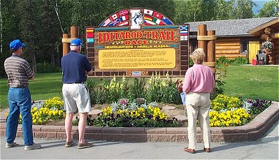
The
Alaska natives created a network of trails in interior Alaska in the early
1800's. Segments of these trails later became the Iditarod Trail. The trail got
its name from a 19th century Athabascan Indian Village. Dog teams and sleds were
the most popular mode of travel. Six to twenty dogs, depending on the weight of
the load, were harnessed to pull a freight-laden sled. The Russians introduced
the harnessing of the dog teams in-line for better control. During the winter,
lakes were covered with snow and ice making the Iditarod Trail the favored
winter route by those traveling to mining districts. In 1908, the Alaska Road
Commission formally surveyed, cleared, and marked the trail. Roadhouses sprung
up. Dog mushing mailmen, gold shipments, and scheduled freight service made the
Iditarod the link between many communities in Western Alaska for nearly two
decades.
In 1924 bush pilots began flying the mail, freight and
passengers in and out of mining camps and villages along the Iditarod Trail. Air
service eventually eliminated the need for the trail. Alaskans continued to use
dog teams for trapping and local travel until snowmobiles came into prominence.
By the 1950's dog teams began to disappear. The Iditarod was almost forgotten
for more than 40 years, then in 1973 a dog race was introduced between Anchorage
and Nome. Today the Iditarod Trail Sled Dog Race is internationally known as
"the last great race". Winter recreational opportunities on the Iditarod Trail
include snowmobiling, dog sledding and cross country skiing. In the summer,
sections of this 1,150-mile trail are used for hiking and running
marathons.
 On Saturday we drove to Valdez and what a beautiful site this was. We
went over mountains and wound through valleys. We saw snow-capped mountains,
another glacier, streams, rivers and breathtaking waterfalls. We even went
through Thompson Pass where records indicate that:
On Saturday we drove to Valdez and what a beautiful site this was. We
went over mountains and wound through valleys. We saw snow-capped mountains,
another glacier, streams, rivers and breathtaking waterfalls. We even went
through Thompson Pass where records indicate that:
Guess there
is no wonder that there are glaciers in the area with that kind of
snowfall!
Valdez was established in 1897 as a port of entry for
prospectors bound for the Klondike goldfields. Until 1964, the town was located
about 4 miles east of its present location. The Good Friday earthquake virtually
destroyed Valdez. Centered in Prince William Sound, the quake measured 9.2 on
the Richter scale. Waves, caused by massive underwater landslides, swept over
and engulfed the Valdez wharf, taking 33 people with it. Seismic action shook
the whole town with overwhelming power causing much damage, however only the
waterfront was completely destroyed. After the earthquake, the Army Corps of
Engineers determined the town was unsafe and suggested relocation. By 1968, the
last resident was moved to the new Valdez.
Valdez has always been an
important gateway to the interior of Alaska, since it is the most northerly
ice-free port in the Western Hemisphere. In 1974, construction began on the
trans-Alaska pipeline. The 800 mile long pipeline begins at Prudhoe Bay on the
Artic Ocean and ends at Valdez. The first tanker load of oil shipped out of
Valdez on Aug 1, 1977. On Good Friday in March 1989, again national attention
was focused on Valdez when the oil tanker Exxon Valdez ran aground on Bligh Reef
(only 30 miles from Valdez) spilling over 11 million gallons of oil. Today
Valdez appears to be a quaint town and we suspect its survival is due to the
friendly people.
Upon our arrival to town the Rishell's treated us to a
delicious dinner. After dinner we went to the Valdez production "Boom Town
Show", a musical comedy from the gold rush era. On entering the show each person
was given a "Skeeter" (kazoo - whistle type item that you hum into). During the
show when mosquitoes (did you know that mosquitoes live an average of 2 weeks
during the summer, although some may live to the ripe old age of 1 month?) were
talked about, we were all to hum into the "Skeeter". This audience participation
was good for a few more laughs. The show basically gave us a lighthearted look
at the historical trials and tribulations of living in Valdez. At the end, we
were encouraged to take our "Skeeters" with us since "recycled kazoos are not
very popular!"

 The next morning a few of us attended church on the 75-foot cruise
ship, the Lu Lu Belle. First Baptist Church sponsors this service. We motored
into Prince William Sound, then drifted for 45 minutes for hymns and worship.
This beautiful boat of teak, mahogany and oriental rugs was certainly not your
average place to hold a church service. That afternoon one couple took a
narrated tour of Prince William Sound in the Lu Lu Belle. The rest of us
investigated the salmon spawning creeks but found we were between spawning runs.
The next morning a few of us attended church on the 75-foot cruise
ship, the Lu Lu Belle. First Baptist Church sponsors this service. We motored
into Prince William Sound, then drifted for 45 minutes for hymns and worship.
This beautiful boat of teak, mahogany and oriental rugs was certainly not your
average place to hold a church service. That afternoon one couple took a
narrated tour of Prince William Sound in the Lu Lu Belle. The rest of us
investigated the salmon spawning creeks but found we were between spawning runs.
We also learned that tours of the pipeline terminal have been
discontinued since 9/11. It has been interesting to note the numerous locations
along our travels where we have had sight of the pipeline. The 25-year-old
trans-Alaska pipeline stretches from Prudhoe Bay, on Alaska's North Slope, to
Valdez, 800 miles to the south. It is one of the largest pipeline systems in the
world, and crosses some of the harshest terrain in the world, including three
mountain ranges. Although oil was discovered in Prudhoe Bay in 1968, it took
nine years to get approval from Congress and then to accomplish the design and
construction. Employing almost 70,000 workers and costing $8 billion, it was the
largest privately funded project in the world at that time.
Here are
some other "pipeline facts":


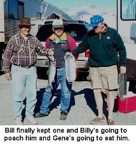 During our stay in Valdez, we celebrated Marti's birthday with a
potluck at the Moore's coach followed by a game of Spinner (similar to Dominos),
which appropriately, Marti won. Our fisherman extraordinaire, Bill Rishell
landed a fresh salmon, which was poached and enjoyed together at an impromptu
picnic.
During our stay in Valdez, we celebrated Marti's birthday with a
potluck at the Moore's coach followed by a game of Spinner (similar to Dominos),
which appropriately, Marti won. Our fisherman extraordinaire, Bill Rishell
landed a fresh salmon, which was poached and enjoyed together at an impromptu
picnic.
Our trip from Valdez to Haines took us back to Tok and briefly
through the Yukon Territory, with an overnight at Destruction Bay. This village
is located on the shore of Kluane Lake and is one of several towns that grew out
of the building of the Alaska Highway. It earned its name when a storm destroyed
buildings and materials in Destruction Bay. We thought it was appropriately
named because of the destruction and construction of the roads in this area!
While at Destruction Bay we saw lots of black spruce burl wood. Bill Moore
bought two burl posts, which he had trimmed to 96 inches so they would fit in
the basement of the coach. He's not sure if he bought these on an urge or as an
investment.


 We have been really looking forward to seeing Haines because it is
known as the "Valley of the Eagles". It was planned that Haines be at the end of
the trip because, at the end of summer, over 74,000 chum salmon return to this
area to spawn and then die, creating a banquet time for eagles. There are
typically about 400 eagles that live in Haines year round; however, in the fall,
that number swells to over 3500 due to the free chum chow. The town's population
of 1,811 also swells as camera-toting eagle-watchers converge on the town,
hoping to capture that perfect shot.
We have been really looking forward to seeing Haines because it is
known as the "Valley of the Eagles". It was planned that Haines be at the end of
the trip because, at the end of summer, over 74,000 chum salmon return to this
area to spawn and then die, creating a banquet time for eagles. There are
typically about 400 eagles that live in Haines year round; however, in the fall,
that number swells to over 3500 due to the free chum chow. The town's population
of 1,811 also swells as camera-toting eagle-watchers converge on the town,
hoping to capture that perfect shot.
Haines straddles a narrow peninsula
between the Chilkoot and the Chilkat rivers and is literally at the end of the
road, where the Haines Highway meets the sea. Picturesque Haines is drier than
many of the southeastern communities and boasts only 60 inches of precipitation
during a year. There are a number of things to do in Haines. At Fort William
Seward National Historic Landmark, one can explore the cemetery and many
historical buildings. Haines is a favorite area for fishermen - after all, 3500
eagles can't be wrong! Haines is also an artist's haven. There is a veritable
smorgasbord of handmade items from which to choose. Lolly and Mary Catherine
bought an interesting pair of earrings, made from walrus whiskers. 
 And then there was the American Bald Eagle Foundation, where we saw
lots of "stuffed" Alaskan wildlife and learned about eagle migration and
habitat. Eagles are known as raptors or birds of prey. But eagles aren't bald.
The old Welsh word "bald" meant "streaked or marked with white". These very big
birds weigh from 10 to 13 pounds and have a wingspan of 6 to 8 feet. The females
are larger than the males and both have the white heads and tail feathers. They
typically fly at 30 mph, but increase that speed to 100 mph when they dive for
prey. Their strong eyesight allows them to see fish up to two miles away. This
powerful vision is 20 to 25 times better than our own vision. It is thought that
eagles mate for life, which may last up to 30 years. Their nests are about 5
feet wide and 3 feet deep and have been known to last for up to 50 years. An
eagle can build a new nest in 4 days, and in southeast Alaska it is estimated
that there is an active nest for every mile of shoreline. Less than 10% of the
eaglets survive to become adults. Most die of starvation or are attacked and
devoured by their siblings. Eagles must be five years old before they develop
the white head and tail feathers. Alaska boasts a total eagle population of
40,000 to 50,000, depending on the salmon runs. (World wide, the population
totals between 80,000 and 100,000.) Several evenings we drove along the Chilkoot
River and we were delighted to see eagles high in the spruce trees.
And then there was the American Bald Eagle Foundation, where we saw
lots of "stuffed" Alaskan wildlife and learned about eagle migration and
habitat. Eagles are known as raptors or birds of prey. But eagles aren't bald.
The old Welsh word "bald" meant "streaked or marked with white". These very big
birds weigh from 10 to 13 pounds and have a wingspan of 6 to 8 feet. The females
are larger than the males and both have the white heads and tail feathers. They
typically fly at 30 mph, but increase that speed to 100 mph when they dive for
prey. Their strong eyesight allows them to see fish up to two miles away. This
powerful vision is 20 to 25 times better than our own vision. It is thought that
eagles mate for life, which may last up to 30 years. Their nests are about 5
feet wide and 3 feet deep and have been known to last for up to 50 years. An
eagle can build a new nest in 4 days, and in southeast Alaska it is estimated
that there is an active nest for every mile of shoreline. Less than 10% of the
eaglets survive to become adults. Most die of starvation or are attacked and
devoured by their siblings. Eagles must be five years old before they develop
the white head and tail feathers. Alaska boasts a total eagle population of
40,000 to 50,000, depending on the salmon runs. (World wide, the population
totals between 80,000 and 100,000.) Several evenings we drove along the Chilkoot
River and we were delighted to see eagles high in the spruce trees.
The
Nelsons and the Moores flew to Juneau for the day. We climbed aboard a six seat
Cherokee and 35 minutes later we were landing. After selecting a taxi/tour
guide, we were off to see the Capital of Alaska. The population of Juneau is
30,711, making it the third largest city in Alaska. Juneau is located on the
Gastineau Channel in the inside passage and is only accessible by boat or plane.
It is 600 miles south of Anchorage. Juneau was named for Joe Juneau who, with
his friend Dick Harris, found gold in the creek that runs through town. That led
to the discovery of one of the largest lodes of gold in the world.  Juneau is a beautiful city. In 1995
the Los Angeles Times listed Juneau among the top ten cruise destinations in the
world because of its scenic beauty and shopping opportunities. The Juneau
Municipal Airport and Alaska State Ferry system provide transportation services
to the city. The longest road in Juneau begins downtown and runs 40 miles north
to a place called Echo Cove. There is no road to the outside world, and the
terrain forbids building one, since the city pushes up against the Juneau
Icefield.
Juneau is a beautiful city. In 1995
the Los Angeles Times listed Juneau among the top ten cruise destinations in the
world because of its scenic beauty and shopping opportunities. The Juneau
Municipal Airport and Alaska State Ferry system provide transportation services
to the city. The longest road in Juneau begins downtown and runs 40 miles north
to a place called Echo Cove. There is no road to the outside world, and the
terrain forbids building one, since the city pushes up against the Juneau
Icefield.
During the trip to Juneau, we visited the Macaulay Salmon
Hatchery operated by Douglas Island Pink and Chum, Inc., a major producer of
salmon for southeast Alaska. Every summer, salmon make their way home: into
Cross Sound, through Icy and Chalkam Straits, down Lynn Canal and into Gastineau
Channel, all the way to the Macaulay Salmon Hatchery. They are accompanied by
other salmon, all heading to their streams of origin, intent on reproducing,
after which they die. It's the natural process. Not all the fish make it back to
the hatcheries; predators consume 96%, 2% are caught by commercial fishermen,
and 2% (which is over 2 million) return to the hatchery.
There are five
different species of salmon. Your fingers provide a simple way of remembering
each of them: 
Macaulay Salmon Hatchery
is a non-profit organization. It was extremely interesting to watch the salmon
returning to the site of their birth. When hatched they identify with the water
they are in, which enables them to return there to spawn. When they arrive back
at the hatchery, they climb the fish ladder and into holding tanks, where they
are held until the hatchery is ready for them. Then they are moved along to an
egg taking process. From here the eggs are placed in a container, fertilized,
and carefully supplied with oxygen and fresh water. Several months later the
eggs hatch, and emerge as fry, or tiny salmon. When the fry are less than one
inch long, they are moved to net pens and fed dry fish food. Six months after
fertilization, pink and chum salmon fry are ready to enter the salt water. It
takes king and silver fry an additional year of freshwater rearing before they
can adapt to saltwater. After the fish are released, they are on their own until
the day they instinctively know it's time to return, in 3 to 5 years. It is
truly miraculous.
 The Ricks and the Rishells took the fjord boat trip to
Juneau. On the trip we saw seals, porpoise, and eagles, and we saw whales
"bubblenetting". This is when a group of ten to twelve whales, led by a dominate
female, start at the bottom of the water swimming in a circle. This action
causes fish to be trapped in the column of air bubbles. Then the whales begin
swimming to the top with their mouths open, to capture all this food. When they
reach the top, all of the whales will surface almost simultaneously. What a
remarkable sight, and almost impossible to catch on camera!
The Ricks and the Rishells took the fjord boat trip to
Juneau. On the trip we saw seals, porpoise, and eagles, and we saw whales
"bubblenetting". This is when a group of ten to twelve whales, led by a dominate
female, start at the bottom of the water swimming in a circle. This action
causes fish to be trapped in the column of air bubbles. Then the whales begin
swimming to the top with their mouths open, to capture all this food. When they
reach the top, all of the whales will surface almost simultaneously. What a
remarkable sight, and almost impossible to catch on camera!
On arriving
in Juneau, we boarded a tour bus to see the sights. We traveled by the
Governor's House, a colonial style home built in 1912. Outside the house was the
Governor's Totem Pole, which tells the Tlingit (native Alaskans) story of the
origin of the mosquito. We visited downtown Juneau, once a home to thirty bars
and several bordellos, now full of inviting gift shops, restaurants and art
galleries. Within a seven-block radius there are sixty buildings built before
1904, and 143 buildings built before 1914. At the Alaska State Museum we saw
Native Alaskan artifacts and learned about Alaska's Russian and American
history. The tour ended with a trip to the mighty Mendenhall glacier. Mendenhall
is a slow moving river of ice that is presently 13.5 miles long and 1.5 miles
wide. Juneau's ice-age monolith still dominates the valley it once covered. Snow
that fell over 200 years ago is just now reaching sea level.  Everyone that saw Juneau agreed that
more than one day was needed to really appreciate all that it has to offer.
Everyone that saw Juneau agreed that
more than one day was needed to really appreciate all that it has to offer.
Skagway is Alaska's northernmost stop on the Alaska Marine Highway's
inside passage, so we thought it was in order to go there by boat. By
land, the distance between Skagway and Haines is 359 miles, but by water
it is only 13 miles. The Alaska Marine Highway System is the longest ferry
route in the world. Operating since 1963, the nine-vessel fleet provides
regularly scheduled passenger and vehicle service to 33 Alaskan
communities. Fortunately for us, any vehicle that is legal on the road
system can be shipped on an Alaskan state ferry.


 The planked boardwalks, the horse drawn carriages, and the folks in
1890's attire that we saw on arrival to Skagway, all gave us the feeling of
taking a giant step back in history. In its heyday, Skagway was the boomtown
gateway to the 1898 trail to the Klondike gold fields. The current year round
population is about 800, a far cry from the 20,000 that inhabited the town
during the gold rush craze. At that time, the notorious "Soapy" Smith ran
Skagway.
The planked boardwalks, the horse drawn carriages, and the folks in
1890's attire that we saw on arrival to Skagway, all gave us the feeling of
taking a giant step back in history. In its heyday, Skagway was the boomtown
gateway to the 1898 trail to the Klondike gold fields. The current year round
population is about 800, a far cry from the 20,000 that inhabited the town
during the gold rush craze. At that time, the notorious "Soapy" Smith ran
Skagway.
We learned more about "Soapy", and his demise, at a very
enjoyable play called "The Days of '98", that has been running since 1927. It
seems that Smith and his motley crew had a thriving con going, fleecing
unsuspecting prospectors. On July 8, 1898 this ended abruptly when Frank Reid,
the town surveyor, put a bullet in Smith's heart. Reid was also mortally wounded
in the shootout, and died 12 days later. The burial sites of both men can be
seen at the Skagway cemetery located about 1.5 miles from downtown.
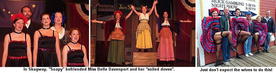

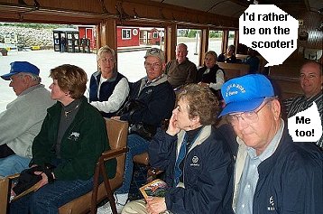
 Skagway is currently the 17th most visited port in the
world. During the 3 days that we were there, we saw as many as four cruise
ships at the docks. The town was bustling with tourists from both the
ships and the full RV parks. We met some of these folks on the White Pass
train trip that our whole group took. This was a 40 mile, 3.5 hour,
narrated summit excursion. An engineering feat, the White Pass and Yukon
Route is one of the steepest narrow-gauge railways in the world. Completed
in 1900, it climbs 2,865 feet with 4% grades around cliff-hanging turns
for 20 miles. In vintage parlor cars, this trip gave us unsurpassed
panoramic views of waterfalls, gorges, and Alaska's breathtaking
wilderness. It was a real eye-opener to see this incredibly rugged terrain
that the stampeders had to traverse to get to the gold fields. It is also
interesting to note that of the 100,000 people who headed for the
Klondike, only 40,000 made it to Dawson City. Of those, 4000 found gold,
with only a few actually striking it rich. And of those few, only a
handful had enough left to pass it on to their children.
Skagway is currently the 17th most visited port in the
world. During the 3 days that we were there, we saw as many as four cruise
ships at the docks. The town was bustling with tourists from both the
ships and the full RV parks. We met some of these folks on the White Pass
train trip that our whole group took. This was a 40 mile, 3.5 hour,
narrated summit excursion. An engineering feat, the White Pass and Yukon
Route is one of the steepest narrow-gauge railways in the world. Completed
in 1900, it climbs 2,865 feet with 4% grades around cliff-hanging turns
for 20 miles. In vintage parlor cars, this trip gave us unsurpassed
panoramic views of waterfalls, gorges, and Alaska's breathtaking
wilderness. It was a real eye-opener to see this incredibly rugged terrain
that the stampeders had to traverse to get to the gold fields. It is also
interesting to note that of the 100,000 people who headed for the
Klondike, only 40,000 made it to Dawson City. Of those, 4000 found gold,
with only a few actually striking it rich. And of those few, only a
handful had enough left to pass it on to their children.
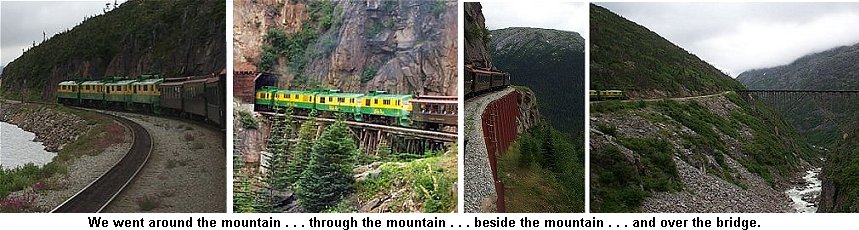
During the next part of our trip we made three border crossings and
retraced the section of highway between Whitehorse and Watson Lake in the
Yukon. On our return trip we selected different campgrounds in which to
stay, however our meal at Mukluk Annie's was so good we decided to return
there one night for dinner. After the meal we were invited to cruise the
lake on their houseboat. We were rewarded with beautiful scenery and
interesting stories about the owner and the area.


This day was to be our best bear-sighting day. The first bear was a
large black bear that crossed the road in front of our group and ambled up the
mountainside before crossing an old logging road and no, we didn't get his
picture. Later on, we had four separate sightings of small black bears, each one
along the side of the road and usually within camera range. We suspect each was
a young cub recently turned out on it's own by mama to fend for itself. They
were probably not wise to the dangers presented by humans and roadways and
seemed to be feeding on vegetation along the highway.

 As earlier mentioned, our destination was Hyder, together with the
adjoining town of Stewart, BC. These two towns, separated by only two miles, are
located at the head of the Portland Canal on the AK/BC border at the
southeastern tip of Alaska. Hyder has about 100 residents and Stewart has
approximately 650. This is an area that has glaciers, bears, eagles and salmon
in profusion. Summers are cool and rainy and winters are fairly moderate but
with heavy snowfall. These two towns are surrounded by soaring mountain peaks
that still retain snow in protected areas and higher elevations. The steep
mountainsides are covered with cascading waters from snowmelt and glaciers.
Since the fog and clouds obscured many of the peaks when we arrived, it appeared
that the waterfalls were originating from the base of the clouds. The
surrounding lowlands are very lush, very green.
As earlier mentioned, our destination was Hyder, together with the
adjoining town of Stewart, BC. These two towns, separated by only two miles, are
located at the head of the Portland Canal on the AK/BC border at the
southeastern tip of Alaska. Hyder has about 100 residents and Stewart has
approximately 650. This is an area that has glaciers, bears, eagles and salmon
in profusion. Summers are cool and rainy and winters are fairly moderate but
with heavy snowfall. These two towns are surrounded by soaring mountain peaks
that still retain snow in protected areas and higher elevations. The steep
mountainsides are covered with cascading waters from snowmelt and glaciers.
Since the fog and clouds obscured many of the peaks when we arrived, it appeared
that the waterfalls were originating from the base of the clouds. The
surrounding lowlands are very lush, very green.
The Portland Canal is a
narrow salt-water fjord about 90 miles long, which defines the boundary between
southernmost Alaska and Canada. Stewart's deep harbor is Canada's most northerly
ice free port. The native Indians gave the head of the canal a name meaning
"safe place". They used the surrounding area to hunt birds and pick
berries.
With the coming of the white man, gold and silver mining
dominated the early economy. Rich silver veins were discovered near Hyder in the
upper Salmon River basin. The town became an access and supply center for the
mines while Stewart served as the center for Canadian mining activity. By 1956,
mining activity ceased with the exception of the Granduc copper mine, which
operated until 1984. Today's economy is based upon forestry and
tourism.
We set out to explore the towns upon arrival in mid-afternoon.
The women visited the shops and made reservations for dinner. Others washed
vehicles or visited the Fish Creek Wildlife bear viewing area that is so
popular. No bears were visible in the afternoon but we all planned to return
following dinner. Our dinner that evening at the Bitter Creek Cafe in Stewart,
prepared by chef Debbie Kremzar, was by unanimous agreement "the best we've had
on the entire trip," and we immediately made reservations for the next
evening.


 As we drove through Hyder on several occasions, Ginger, a local horse
roaming free on the dirt streets, welcomed us. Alaska observes free range for
animals, except in cities, so Ginger was free to greet anyone who stopped. The
accompanying photo attests to her friendliness. We dubbed her "an employee of
the local chamber of commerce".
As we drove through Hyder on several occasions, Ginger, a local horse
roaming free on the dirt streets, welcomed us. Alaska observes free range for
animals, except in cities, so Ginger was free to greet anyone who stopped. The
accompanying photo attests to her friendliness. We dubbed her "an employee of
the local chamber of commerce".
Following another fine "dinner by
Debbie", Frank, Debbie's husband, gave us a tour of his toaster museum. He
proudly showed some of his 800 antique toasters and answered questions we posed.
This was a fitting climax to an enjoyable day.

 We were told that, by this time of year in Alaska and
Canada, there would be lots of recreational vehicles and we found this to be the
case. On one stretch of highway we counted five RV's in front of us and 27
behind. Wow, what a caravan!
We were told that, by this time of year in Alaska and
Canada, there would be lots of recreational vehicles and we found this to be the
case. On one stretch of highway we counted five RV's in front of us and 27
behind. Wow, what a caravan!  In Houston, BC, we came across the world's largest fly fishing rod.
Since Bill Rishell is an avid fly fisherman, we just had to stop and get his
picture. This 60 foot long anodized aluminum rod was designed by a local
fisherman and built by local volunteers. It has a 21-inch fly, which is a
fluorescent "Skykomish Sunrise". At our request, Bill has furnished us with the
following information.
In Houston, BC, we came across the world's largest fly fishing rod.
Since Bill Rishell is an avid fly fisherman, we just had to stop and get his
picture. This 60 foot long anodized aluminum rod was designed by a local
fisherman and built by local volunteers. It has a 21-inch fly, which is a
fluorescent "Skykomish Sunrise". At our request, Bill has furnished us with the
following information.
The basic tools of the fly fisherman are a rod
and reel, on which is wound a line and leader, to which is attached the fly.
Rods come in various lengths, usually from 7 to 9 feet, and weights ranging from
very light to heavier rods with more muscle for handling larger, heavier fish.
Thus, a 5 weight-eight and one half foot rod is a suitable trout rod - a 2
weight rod of the same length would handle panfish and a 10 weight-9 foot rod
would be suitable for larger and heavier Alaskan salmon. Today's rods are made
of high tech boron or graphite.
Just like the rod, fly lines come in
various weights. They may be made to float or sink, depending on the objective
of the fisherman. An 8-weight line would be used with an 8-weight rod and wound
on a reel of sufficient size to hold about 100 yards of line. A leader is
attached to the end of the line and transfers the energy of the line to cast the
fly. The leader is a tapered monofilament (heavier at the butt end where it is
attached to the line) and finer at the end to which the fly is tied.
To
make a cast, line is stripped from the reel; the rod is lifted overhead and
moved smartly forward and backward as the line shoots outward. Timing of this
movement is critical to obtaining a desirable cast, but an accomplished
fisherman can deliver the fly 50 or so yards and drop it within a desirable
area.
The fly contains the hook, which is tied to imitate insects,
baitfish, shrimp, larvae or other forms of food. Some flies are tied merely to
give flash or color which stimulates the fish to strike. A great diversity of
materials is used to construct the fly. These materials include thread,
feathers, furs, hair and all manner of synthetic materials. There are literally
thousands of "recipes" for the many flies that are in use today.

The Monaco Five arrived at Prince George, British
Columbia in the late afternoon and prepared for our last gathering, as the
Monaco Five, with a progressive dinner. We began with cheese fondue at the
Moores, and moved to marinate grilled chicken breasts with fancy trimmings at
the Rishells, and topped it off with individual Igloo desserts at the Ricks.

COCONUT IGLOOS
1 stick of margarine
1 cup sugar
1 ¼ lb
can drained pineapple
1 cup currants
1 cup chopped pecans
1 box
(8 oz) butter cookies
1 large Cool Whip
1 package frozen coconut
(thawed)
Maraschino cherries
Blend margarine and sugar. Add
pineapple, currants and pecans. Spread mixture between cookies three
cookies deep. Let set 8 hours at room temperature. Frost each igloo with
the Cool Whip and cover with coconut. Place in refrigerator until ready to
serve.
Gene was acknowledged and presented with a token of our thanks for
initiating the Alaska trip and choosing the Monaco Five. Benevolence and
accolades were given to Mary Catherine and Graham - our tour directors,
web site designers and chief electrician. Since all of the guys had
acquired a "playmate" during the trip except Graham, he was presented with
"Diesel Dog" to remind him of all the diesel fuel the guys handled while
repairing his fuel tank. Much reminiscing and picture taking was done and
departing good-byes were said.


We visited the Prince George
Railway and Forestry Museum. This museum features a dozen original railway
buildings, including 2 stations. Among the 50 pieces of rolling stock are 5
locomotives, a couple of snow plows, a 100-ton steam wrecking crane and a
90-foot turntable. The museum was an interesting industrial heritage attraction
in a spacious park-like setting, where we were free to enjoy a "hands on - climb
aboard" experience.


Canada Olympic Park is a truly
unique facility, situated at the gateway to the magnificent Rocky Mountains. It
is a multipurpose competition, training and recreation area designed for
year-round use by athletes, visitors and the general public. On the tour we
explored the Olympic Hall of Fame and Museum. In was neat to get up close to
gold, silver and bronze medals.
On August 3rd we headed for Calgary, Canada's fourth largest city. It
is set in the rolling foothills against the Canadian Rockies. The Bow
River, well known to the Canadian Fly fisherman, divides the city into
north and south. Visitors can fish right downtown and stroll, jog or cycle
along the river.
On arriving in town we stopped at Canada Olympic
Park, where the 1988 Winter Olympics were held. They offered a special
family rate for a guided tour. Billy told the nice young lady he was here
with his two brothers and three sisters. Graham started to laugh, but she
gave us the family rate with a wondering glance. 


IMAX uses the largest film
frame in motion picture history - more than ten times the size of conventional
35mm and three times the size of standard 70mm. That means breathtaking images
of unsurpassed size and impact. The IMAX projector uses a unique "rolling loop"
to advance the huge film at 24 frames-per-second with a gentle, waving action.
There is also a six-channel digital sound system that adds to the sensation of
being in the middle of a real event. IMAX Corporate headquarters are located in
Toronto, Canada. Each year more than 30 million people worldwide enjoy the IMAX
experience. We found that seeing an IMAX film is an amazing experience. It puts
you in the center of the action in a way no ordinary movie can, drawing you in
with images that are so real you want to touch them. The IMAX theatre we visited
in Calgary is the 100th theatre in the IMAX network.

The next morning, a visit to the Devonian Gardens
surprised us. Alberta's largest indoor garden, 2.5 acres in the heart of
downtown Calgary, was on the third floor! The garden includes 20,000 plants of
138 local and tropical varieties; fountains, waterfalls, reflecting ponds (with
fish food available to feed gold fish and rainbow trout), bridges and a
playground.

The 5th and 6th were long traveling days, averaging about 430 miles
each day. We made a brief stop in Medicine Hat to check out the world's
tallest tepee. In 1988, at the Calgary Winter Olympics, this giant tepee
shaped structure towered over the Olympic cauldron. Upon learning that the
20-story tepee was to be destroyed, a businessman from Medicine Hat saw
the opportunity to fulfill his dream of building a monument to the natives
of Canada. Built entirely of steel on a concrete foundation, the tepee is
said to have more engineering challenges in its construction than the
famous Eiffel Tower. The structure weighs almost 1000 tons and is built to
withstand extreme temperatures and 150 mph winds. Attached to the tepee
are ten large storyboards that depict various aspects of native culture
and history.


We began the morning
with a trip to the Royal Canadian Mint. The Mint was originally established in
Ottawa (the capital of Canada) in 1908 to produce Canada's circulation coins. It
soon became an international producer of coins for countries around the world.
The Winnipeg plant that we toured was built in 1976 for high speed and high
volume production of circulation coins. We saw a film on the coin production
process and then were given a very informative tour through the plant, were we
saw the coins being made. At the gift shop we had an opportunity to see up close
some of the unusual shapes and sizes that are minted there for other countries.


While we were there, we had the opportunity to see Golden Boy being
restored. Golden Boy is the statue that sits atop Manitoba's Legislative
Building. This statue is over 17 feet tall and weighs 3,640 pound. It was
determined that after 82 years the statue's internal support post had
corroded and needed replacing. Golden Boy also needed a new coat of gold
and some minor surface repairs. The statue was taken to the marketplace at
The Forks for this re-gilding process so Canadians could watch. It is
being covered in 24-carat gold leaf, which is being applied one very small
sheet at a time. The Queen of England will officially unveil the restored
Golden Boy during a public ceremony on October 8, 2002. Then it will be
returned to the dome of the Legislative Building.

 From The Forks we "took a trip to the tropics" at the Club Regent
Casino. This casino has Mayan ruins, cascading waterfalls, contiki torches and
jungle creatures. One of these jungle creatures, a toucan, struck up a
conversation with us when we arrived. We talked with him for a few minutes and
then he began to ask to go home with us. Our conservation ended when he
suggested that we get rid of Hope the cat and replace her with him! We took a
quick tour of the place and left before anyone lost any money.
From The Forks we "took a trip to the tropics" at the Club Regent
Casino. This casino has Mayan ruins, cascading waterfalls, contiki torches and
jungle creatures. One of these jungle creatures, a toucan, struck up a
conversation with us when we arrived. We talked with him for a few minutes and
then he began to ask to go home with us. Our conservation ended when he
suggested that we get rid of Hope the cat and replace her with him! We took a
quick tour of the place and left before anyone lost any money. During the first weeks of August,
Winnipeg sponsors Folk-o-rama, the largest and longest running multicultural
festival of its kind in the world. Representing cultures from around the world,
this two-week event is chocked full of culture, dance, music, food and art.
Forty-seven pavilions all over Winnipeg produce traditional home-cooked meals,
ethnic displays, and three nightly performances by entertainers.
During the first weeks of August,
Winnipeg sponsors Folk-o-rama, the largest and longest running multicultural
festival of its kind in the world. Representing cultures from around the world,
this two-week event is chocked full of culture, dance, music, food and art.
Forty-seven pavilions all over Winnipeg produce traditional home-cooked meals,
ethnic displays, and three nightly performances by entertainers.
Since
the Nelsons are of Scandinavian descent, we decided to go to that pavilion. We
toured their displays, observing demonstrations and making some great needlework
purchases. Dinner was a delicious meal of roasted pork, potatoes and red
cabbage. While we ate, three generations from the local community presented a
show featuring song, dance and age-old customs.
We enjoyed our first
pavilion so well that we decided to stop at another one. The African/Caribbean
pavilion was within a few blocks so we went there. Before the show we checked
out the cultural displays of handmade crafts and clothing. The show featured a
very limber Limbo Dancer from Jamaica and a steel drum band. Graham was chosen
from the audience to have a Limbo lesson. He bravely and successfully went under
the bar!


After a 20-minute
ferry ride to the island, we hiked to the Grand Hotel, the focal point of the
island. The Grand Hotel opened on July 10, 1887 and has always been considered
the world's largest summer hotel. The porch at the Grand Hotel is 650 feet long,
across which 100 rocking chairs are lined. Five U.S. Presidents have stayed at
the Grand Hotel including Presidents Clinton, Bush, Ford, Kennedy and Truman.

After lunch we waddled back down to the docks to catch a carriage
tour of the island. The descendants of the original carriage men are still
responsible for the Mackinac Island carriages. The company that runs this
operation is the oldest livery service in the country, and the world's largest
horse-and-buggy livery. They own and operate about 100 horse-drawn vehicles that
utilize approximately 400 horses. We found the tour a perfect way to see the
island. At the end of the day, we were glad that we could be counted as one of
the more than one million people to visit Mackinac Island each
year.
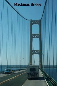
 This, the world's largest suspension bridge, was started on May 7,
1954 and finished only 42 months later, right on schedule on November 1, 1957.
Until the bridge was built, it took two hours to travel the 17 miles by ferry,
across the great lakes that separate the state of Michigan into two parts. A
maximum of 462 cars could be carried at a time. Now that the bridge is finished,
over 6000 cars can cross in a single hour. The towers that support the bridge
are 552 feet tall (the same height as the Washington Monument). During
construction only five workers lost their lives, a phenomenal feat considering
over 11,000 people worked on the bridge.
This, the world's largest suspension bridge, was started on May 7,
1954 and finished only 42 months later, right on schedule on November 1, 1957.
Until the bridge was built, it took two hours to travel the 17 miles by ferry,
across the great lakes that separate the state of Michigan into two parts. A
maximum of 462 cars could be carried at a time. Now that the bridge is finished,
over 6000 cars can cross in a single hour. The towers that support the bridge
are 552 feet tall (the same height as the Washington Monument). During
construction only five workers lost their lives, a phenomenal feat considering
over 11,000 people worked on the bridge.
That afternoon we traveled
along the beautiful coast of Lake Michigan. On Monday the 11th we took a slight
detour over to Silver Lakes where we took a ride on the sand dunes. This
2000-acre area of Michigan is located between Lake Michigan and Silver Lake.
Here, huge windswept mountains are moving 10 to 20 feet per year, a few grains
of sand at a time. The sand engulfs trees and is gradually filling in Silver
Lake as it moves eastward. At Mac Wood's Dune Rides, we hopped aboard "dune
buggies" for a seven-mile ride.

 Close by we found the Shelby Gem Factory. This company has created a
process by which "gems" can be man-made. They are chemically and physically
identical to gems produced by nature. The difference between these stones and
real ones is that Shelby stones are nearly flawless, since they control the
ingredients and cooking temperature. In some cases, like with emeralds, the
chemical stones are about 2 times harder and considerable tougher that natural
gems. Another advantage is that they are much less expensive. The day we
visited, the showroom was low on stock, so fortunately nothing was found that we
could not live without!
Close by we found the Shelby Gem Factory. This company has created a
process by which "gems" can be man-made. They are chemically and physically
identical to gems produced by nature. The difference between these stones and
real ones is that Shelby stones are nearly flawless, since they control the
ingredients and cooking temperature. In some cases, like with emeralds, the
chemical stones are about 2 times harder and considerable tougher that natural
gems. Another advantage is that they are much less expensive. The day we
visited, the showroom was low on stock, so fortunately nothing was found that we
could not live without!
Traveling on, we came to Holland, MI. Our first
stop here was at Veldheer's Tulip farm, but it wasn't tulips that we wanted to
see. It was wooden shoes and Delft porcelain.
The wearing of wooden
shoes is an old tradition in the Netherlands, dating back to the 1300's. Because
of the high cost of leather and Holland's wet climate, which causes leather to
rot quickly, wooden shoes developed as the ideal footwear. They are relatively
inexpensive and long lasting. Wooden shoes, despite their inflexibility, are
comfortable and warm when worn with thick socks. In some regions of the
Netherlands, they are still worn today. The shoes are made of willow, a wood
that is both hard and water resistant.  Delft is the name given to a type of pottery, which is traditionally
blue and white and originates from the Netherlands. Delft was first produced in
the city of Delft, from which it derives its name, during the 12th century. It
began as an imitation of oriental porcelains, but gradually evolved its own
style and became recognized and highly valued for its beauty and handcrafted
quality. Today, delft is produced in a variety of colors.
Delft is the name given to a type of pottery, which is traditionally
blue and white and originates from the Netherlands. Delft was first produced in
the city of Delft, from which it derives its name, during the 12th century. It
began as an imitation of oriental porcelains, but gradually evolved its own
style and became recognized and highly valued for its beauty and handcrafted
quality. Today, delft is produced in a variety of colors.
The Delft
process is as follows:
The Pour Room - Delft begins as a liquid clay
slip, which is poured into plaster molds. The clay is allowed to set until the
desired wall thickness is attained. When the piece is removed from the mold, it
retains the mold's form, but is fragile and moist. The pottery, at this point,
is called greenware. After the greenware is trimmed and polished, it is left to
dry before being fired. The Kiln Room - Firing causes the piece to harden and whiten. The
firing takes place in the kilns, or ovens, where the greenware is baked at a
temperature of 1600 degrees. The heating, firing, and cooling is a 24-hour
process. Pottery at this stage is called bisque.
The Kiln Room - Firing causes the piece to harden and whiten. The
firing takes place in the kilns, or ovens, where the greenware is baked at a
temperature of 1600 degrees. The heating, firing, and cooling is a 24-hour
process. Pottery at this stage is called bisque.
The Paint Room - All the
delft made here is entirely hand painted. The artists employ a special
water-based under-glaze, which is imported from the Netherlands and is
unavailable commercially. They freehand paint traditional patterns onto the
pieces, using strokes which embody the style of delft. It requires nearly two
years apprenticeship to learn the art of delft painting.
After the
bisque is painted, it is fired again to set the under-glaze, and then dipped
into an over-glaze. It is during the third and final firing that a chemical
reaction takes place between the blue under-glaze and the clear over-glaze,
resulting in the bright blue color associated with delft.
Our last stop
in this area was at Windmill Island. Here we found a 230-year-old windmill.
"DeZwaan" (The Swan) is the only authentic Dutch windmill operating in the
United States. Windmill Island has a lot to offer. There is the tour of the
windmill, a show by Dutch dancers, a film on the dismantling and reconstructing
of the windmill, a 1895 carousel, a miniature Dutch village, and candle artists
that dip and sculpt candles while you watch. Summer annuals were in bloom and
color was everywhere. They say it is the most beautiful in the spring when the
tulips are in bloom. That's hard to imagine.